Showing posts with label Italy. Show all posts

Monday, 21 February 2022

Lucca Ramparts Running Route

Click here for route map

Length 4.2 km (2.6 mi), terrain: flat, gain 11 meters.

I like Lucca. It's my favorite Tuscan town to visit. Of course, it lacks the spectacular sights of Florence, with that city's Michelangelo statues, amazing palaces, world-class Uffizi art museum, imposing squares, and the Ponte Vecchio bridge lined by old houses. And, of course, Lucca doesn't have Pisa's awesome leaning tower. And, of course again, Lucca is definitely topped by Sienna's impressive Piazza del Campo square, with its Palio horse races twice a year.  
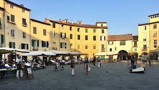
Piazza del Amfiteatro
Lucca's Piazza del Amphiteatro: a great place to eat!

But those towns are also totally overrun by tourists. A typical visit nowadays means shoving your way through packed crowds, being jostled by pick-pockets and being overcharged for everything you consume.

Lucca has its tourists too, but they haven't reach tsunami levels yet.
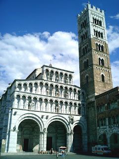
Duomo
The Lucca Duomo (cathedral)

Lucca hits that sweet spot: it's great, but not quite spectacular. Its churches and squares are beautiful and full of Italian craftmanship, but nothing is leaning precariously, and Michelangelo never got any big public commissions there. It's just an ancient town full of winding lanes lined by medieval buildings, beautifully crafted churches and palaces, and an oval square (Piazza del Amfiteatro) built inside an old Roman amphitheater. And to top it off, it's all surrounded by an intact defensive wall around the whole old town. 
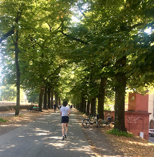
The ramparts are Lucca's most popular running route

The wall -- more a thick earthen rampart -- is Lucca's unique selling point among Italy's myriad amazing towns. And up there, on top of the ramparts, it so happens that you'll find all the city's runners, following the best running route in town.

The rampart paths are lined by trees, providing lots of shade in hot weather. And the quiet, green surroundings, the constant views into the old town's maze of alleys and out into the surrounding parkland outside the ramparts, make it a scenic and pleasant place to be out and about.

Occasional highlights -- Lucca's palaces, gardens and churches -- keep it interesting. And the total lack of traffic and intersections make it a pleasure to follow.

Another positive result of the loop is, of course, it's impossible to get lost up there. Just slip into cruise-mode, follow the wide path, and do one, two or as many 4.2-km laps as you feel.

You can also get on or off at any number of access points. There are city gates with ramps to get down to street-level at each of the four compass coordinates: north, south, east and west, plus a few more ways down along the way.

So, if you're ready to take my advice -- to slip on your running shoes and head out for one memorable run -- just find one of those four gates in the walls. This route officially starts at Porta Santa Maria, the northern gate, but you could start anywhere. 
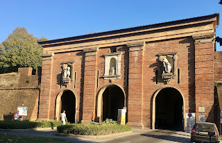
Start here at Porta Santa Maria

Just run through the gate into the old town, and immediately take one of the two ramps leading upwards to either side. Once you're up there among the people strolling the path and hanging out on the benches,(the path is called Via delle Mura Urbane), off you go. I've written up this route to follow the walls going clockwise, with the old town to your right, but that doesn't really matter, either. But most runners up there seem to be heading that way around. 
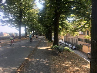
Along the shady ramparts

You'll quickly pass the first of many bulwarks built outwards from the walls, protecting them with ways to shoot sideways at anyone trying to breach the walls. They provide interesting views and are often adorned with statues, monuments, old cannon emplacements, playgrounds and even cafés.

At the second bulwark, the wall turns right and you start running along the eastern side. Just after the 1-kilometer mark, you come to (and run above) the eastern gate, Porta Elisa.

One of my favorite views comes at about the 1.5-km mark, when you pass the botanical garden (Orto Botanico) on the inside of the walls. Very lush and peaceful looking, full of huge cedar trees! You are now running westwards, along the south side. 
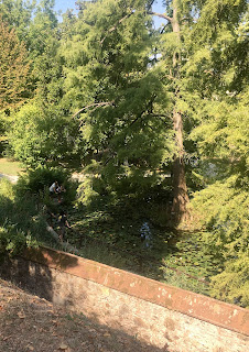
View of Orto Botanico

There are a couple of inviting cafés along this south wall. At the 2-km mark, you'll also run by the back side of the cathedral, the Duomo di San Martino, with its square tower. All in all, this south side a great hangout to come back to later. 
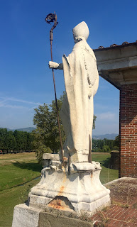
Statue along the west side

The walls gradually turn northwards as you run along the west side. The western gate, Porta Santa Anna, comes up at the 3-km mark. There are a couple of museums in old buildings right along the walls here, one in the old mint (Museo della Zecca) displays old Luccan coins and minting machinery, and the other in the old cavalry stables (Cavallerizza) hosts a lively variety of art exhibits, forums, workshops and festivals.  
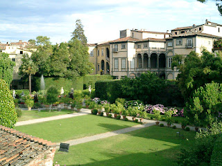
Palazzo Pfanner gardens

Once you are back on the northern wall, at the 4-km mark, you'll pass the last highlight: the view into the formal gardens of Lucca's most famous palace, Palazzo Pfanner, now a posh hotel.

You'll soon be back at the starting point at Porta Santa Maria, where you can head home or start lap number two, as you please. Just make sure you don't over-do it: save enough time and energy for exploring and enjoying Lucca's many other delights within the old walls!

Sunday, 2 December 2018

Best Running Routes in Milan

Street music in Milan
Milan, the city of fashion, has some interesting running spots. The town has some Roman ruins, one of the greatest Renaissance cathedrals in the world, parks, canals and lively neighborhoods, and you can string them together into some great routes. Here are the top Milano runs.
The fashion tram in Milan
Top Milan Running Routes
Historic Sights: This route takes you on a loop through the greatest sights in the city center: the old town and cathedral, the Fashion District, Montanelli Park, then back through Sempione Park and the Sforza Castle before heading back through the shopping district.

Navigli: These historic canals made up Milan's harbor. Now they are Milan's hippest district, full of hole-in-the-wall cafés and restaurants. This run starts at the Duomo and heads past Roman ruins to reach the Navigli neighborhood.

Brera/Sempione: Brera is an elegant neighborhood full of good restaurants, and a great spot for a nice evening out. And it's just a short distance from the city center. Combine that with the beauty of Sempione park, and you've got one nice run!

Naviglio Grande: If you want to see more of the traditional harbor area and its working-class roots, this run along Naviglio Grande is a great addition or extension of the main Navigli route.

Thursday, 24 August 2017

Rena Majore, Sardinia, Italy, Summer Fun-Run

Click here for route map
Length 4.3 km (2.7 miles), terrain: hilly, gain 44 meters

TIP: Be sure to bring your snorkel and cool off after the run with a dip among the rocks!
Snorkelers among the shoreline rocks
If you visit the Italian island of Sardinia, you'll probably hear that Rena Majore is the nicest beach on the island. It stretches-out, isolated on the northwest coast, full of lots of deep sand with additional rocks and cliffs rising all around, waiting to be explored and snorkeled. Add a few kiosks to refresh yourself with a cold drink and some tasty bar food, and -- to put it simply -- it's well worth the visit!
Rena Majore, southern end: great rocks to climb out there!
So, while you're there, strap on your running shoes and follow this short Summer Fun-Run. It will take you along the beach (come to think of it, you should take off your shoes for that part) and then follow the clifftops southwards to the next beach, Rena di Matteu, then head back again.

There are actually three little roads that lead to the beach: one at the north end, one in the middle and one further south. We'll assume that you drove the middle route and that you now find yourself standing on the rocky point used as a car-park which separates the beach into a northern half and a southern half. There's a dilapidated old fisherman's house, built of wood and stone, perched precipitously on the point. 
View north from starting point, with fisherman's house
Because this run is so short, let's add a loop along the northern part of the beach first, running on the compact sand near the water's edge. This is really a cool section: the first part is a little cove created by two rock outcroppings, used by snorkelers.

Then you come to a big dune at the north end of the beach. When you reach the end, turn around and head south again, trying to avoid colliding with the other beach-goers.
View towards southern beach
When you're back at the car park, after 1.5-kilometers, continue following the water's edge along the southern half of the beach. This section is also cool, with its pointy granite rocks marking the southern end of the beach.
Way up
When you come to the rocks, you'll see the trail going straight up the steep hillside. Head up there, then you'll be on the cliff trail, with its falling-down wooden railings. We'll now follow this trail south for another kilometer to the next beach, Rena Matteu. The cliffs roll up and down along the coast, lined with scrubby pines and junipers.
The cliff trail
There are constant views, so make sure you take it in. But watch your step! Some spots are very rocky and steep, better suited for hiking than for a run. But you decide how you'll approach those places.
Approaching Rena Matteu
The trail descends to Rena Matteu beach, where you run along the sand again to the southern end.

So now, just head back north, heading uphill along the cliffs, following the same rocky, beautiful, amazing way that you came.
On the way back: more amazing views!
Now that was one of the most beautiful trails you've ever been on, I'll bet!

Sunday, 3 April 2016

Milan Brera/Sempione Running Route

Click here for route map
Length 4.6 km (2.9 miles), terrain: flat

Milano running routes:
Milan Centro Storico old town loop
Milan Navigli canal route 

Milan Navigli Grande  
Milan Brera/Parco Sempione  route
For more running routes, see Route List.

Brera is one of my favorite neighborhoods in Milan, with its little lanes lined by interesting bars, restaurants and antique shops. And nearby Parco Sempione, with its extensive gardens and giant castle, is the perfect section of green-space to complement it.
Statue in Brera
So this little route combines them together into one memorable run. It actually overlaps the longer Centro Storico run at the beginning and end, but this one has a different flair.

So, if you're ready to discover another great Milan neighborhood, off we go!
There are more pigeons than tourists out front of the Duomo
We'll start -- like the other runs -- right in the heart of the old town, in front of the Duomo cathedral. This is one of the most magnificent churches in the world, with its pink-and-cream marble glowing in the sun.

Turn north and head through the giant archway into the elegant Galleria Vittorio Emanuele II shopping center, with its marble floors and glass dome. You'll have to zig-zag through the shoppers, but we'll soon be out of here.

You'll exit into a little square, the Piazza della Scala, with its statue of Leonardo da Vinci. Across the street, on the left is Milan's famous opera house, La Scala, with the historic trams of Line 1 rolling by.
Tram in front of La Scala
Cross the street to the right side of La Scala and enter that street, Via Guiseppe Verdi, running northwest. The street name changes to Via Brera after a block, and we're entering the Brera neighborhood. You'll pass impressive palaces on the left and right.

The right-hand palace houses the Pinacoteca di Brera, one of the oldest art museums in the world. You can run into the courtyard, dominated by the big bronze statue of Napoleon, who donated a lot of artwork to the museum after closing down numerous Catholic Church institutions.
At the Pinacoteca
Just after the Pinacoteca, you'll see the first bars for this great night-life neighborhood.

Turn left at the first bar, into the pedestrian lane called Via Fiori Chiari, running westwards. This is one of my favorite streets in town, with a relaxed mix of boutiques and restaurants. The street gets narrower as you run westwards.
Fiori Chiari restaurants
The street ends at Via Mercato, where you turn right to head northwards for a few blocks. Cross a busy street with tram tracks and continue northwards, where the street name changes to Corso Garibaldi.

In just a block, you'll pass a church with its little courtyard on the left. Turn left onto the the pedestrian way just after the churchyard, Via Visconti.

This will take you to the street and tram-line that edge the northeast corner of Parco Sempione, at Via Legnano. Keep to the right side and cross the tram tracks and street, and you'll find yourself at the park gate, facing the old sports arena within.
Entering Parco Sempione, with arena straight ahead
Run into the park, towards the arena, then circle it along the right side, with the arena to your left. You'll suddenly find yourself among lots of runners! This is the most popular running area in town.

Circle the arena back to its western entrance, where you are facing south. Now turn right and cross the park westwards.
The western entrance to the arena
When you reach the basketball courts, you can turn left and cross one of the bridges over the narrow pond, with the castle beyond.
Runner crossing the park, with the castle in background
Now just keep towards the right, running westwards, with the brick castle off to the south. Run towards the western side of the castle and run past the castle walls along its western edge.
Running along the castle walls
When you get to the giant round tower at the south end of the castle, turn left to run to the front (south) entrance of the castle, with its tall clock tower.
Heading into Via Dante
Now turn your back to the castle and run past the fountain and cross the street at the Cairoli metro-and-tram station and head past the two pointed, white pavilions to run southeast along Via Dante, a wide pedestrian shopping street.
Musician on Via dei Mercanti
At the next big crossing, where more trams cross the street, keep left to run through Piazza Cordusio and then follow Via dei Mercanti the last two blocks back to the Duomo, past the medieval market and the renaissance Chamber of Commerce.

Friday, 17 July 2015

Venice Burano Running Route

Click here for route map
Length 3.7 km (2.3 miles), terrain: flat, you're in Venice, after all!

Venice running routes:
Giardini Park route
Burano route
For more running routes, see Route List.   

Anyone who has visited Venice's northern lagoon outpost, Burano, is immediately struck by the little island's village character: the simple, colorful, two-story fishermen's homes, the quiet little lanes lining narrow canals, the wide vistas to the distant other lagoon islands.
Canal-side homes in Burano
During the daytime there are a fair amount of visitors exploring the island, but nothing compared to the main attraction areas in Venice itself. And when the tourists leave in the evening, a shroud of tranquility slips back over the island, where the locals can step out into their village world, undisturbed.

NOTE: see the Destinations Tips page for tips about spending your free time in this great town!
 
That's the best time to be in Burano: mornings or evenings when a hush lies over the little alleys and only seagulls create motion along the waterfront. If you want to explore Burano yourself, just jump on a water bus (Motonave lines 12 or 13) from Fondamente Nove.
Housepainter's ladder reflects the colorful paint used on the island
Burano isn't very big, so this route isn't big either, but it's a nice little run. It only got this long by adding a loop through the connected neighboring island of Mazzorbo. Once you know Burano a bit, you might want to add some loops through the western part of town. I avoided that in this route because the ways twist and turn due to dead-ending at the canals.

So if you want to discover one of the most charming, colorful corners of Venice, let's disembark at the Burano ferry landing.
Houses off Corte Comare
When you step off the ferry, you'll see a little wedge of a park on the right, and a lane leading straight into the island, the Viale Marcello.

Follow Viale Marcello southwards the couple of blocks until it comes to the first little canal, at the Riva Rosa restaurant.

Turn left here and run eastwards past the colorful little houses until the canal makes an abrupt turn to the left. You can keep going straight by crossing the wooden bridge, which we'll do.
Along Via Galuppi
So now continue southeastwards on the town's main street, Via Galuppi, lined by little shops and restaurants. You'll see the church, San Martino, and its leaning bell-tower at the end of the street. It's amazing that the tower is still standing at all.

At the church square, keep left and run around the left side of the church to the waterfront behind it. The church square is flanked by the town offices, the Lace Museum and some other scenic, ancient buildings, and is the main hangout for the village kids in the evenings.
Kids at the church square in the evening
Now turn right and run the short way until the next canal blocks your progress, where your turn right again and run northwest along the canal back into town. You'll go by the best restaurant in town, El Gatto Nero (great fish!).

The canal ends by running into that first canal that we ran along earlier, this time in a different spot. Keep going straight by crossing the bridge, and you'll run through a quiet little square lined by more colorful little houses, along Strada di Corte Comare.
Boats at the marina
Keep to the left side of the square and run straight past the last houses into a little green park along the water. You'll see a tiny footpath curving to the right: take that path and it soon joins a real waterfront sidewalk at a little marina full of fishing boats.

Ahead, you'll see a long wooden bridge that connects Burano with its neighboring island of Mazzorbo, off to the left. Mazzorbo is not so densely packed: it's mainly covered by gardens and orchards, creating an airy, green contrast to Burano.

Cross the bridge to Mazzorbo, then turn left to run along the tree-lined trail, running southwest.
The promenade on Mazzorbo
You'll go past some new houses and then the cemetery, where the trail turns right and winds through some houses and comes out at the island's one little canal.

To add some distance, we'll turn left here and add a little loop along the canal. Run to the furthest little bridge over the canal, cross it, and then return to the spot where we joined the canal and its little footbridge.

Now cross the bridge to get back to where you were a minute earlier, and turn left to run north along the canal (water to your left side). The neighborhood definitely has a more rural character, with big gardens lining much of the way.
Running by the bell tower
Now the trail hits the north shore of this little island, where you have to turn right and run back northeast. At the bell-tower in the northern corner of the island, there is a little park which you can cut through, if you feel like a change of scenery.

The trail turns southeast there and you run back towards the bridge to Burano.

After crossing the bridge, just keep going straight, past the triangular park to the ferry landing straight ahead. There, one of the most charming places you've ever run!

Sunday, 5 July 2015

Venice Giardini/Arsenale Running Route

Click here for route map
Length 5.26 km (3.3 miles), terrain: flat

Venice running routes:
Giardini Park route
Burano route
For more running routes, see Route List.   

Venice, with its little alleys packed with tourist masses and little lanes dead-ending into canals, doesn't conjure up the image of a good running venue. But if you know where to go, you can find a few great spots to run along empty streets and through shady parks. Here's a route right in the center of town, but often seeming a world away from the teeming crowds of the Piazza San Marco.
In Giardini Pubblici
If you just walk 15 minutes east of the San Marco tourist crush, you'll find totally quiet streets, green parks and working-class neighborhoods in the Arsenale neighborhood that will immerse you in a totally different side of Venice.

NOTE: see the Destinations Tips page for tips about spending your free time!
 
This route will start at the old Venetian naval headquarters, run through Venice's only real park (Giardini Pubblici) and then continue along the waterfront in Santa Elena and then in working-class San Pietro.
The Venetian Arsenale
So if you want to find some quiet, green, empty lanes, let's head off to the navy headquarters in Arsenale. The twin towers flanking the water entrance into the Arsenale fort compose the Torri dell' Arsenale, and to their left is the impressively decorated headquarters, with its white-marble lions.

Standing there at the lions, turn to the little footbridge that crosses the entry into the naval harbor, in front of the towers. Now cross the bridge and turn right to run south past the maritime museum the couple of blocks to the water of the lagoon.
Along the Riva
Now turn left and run westwards along the various "Riva" sections of the waterfront promenade. The number of pedestrians is already much less than in the center of town.

You'll go by a couple of little parks, but the real green area starts when you reach Giardini. When you see the main entrance, you have a choice of either running through the park or of continuing running along the water, with its wide vistas of the lagoon.
The promenade along Giardini
The Giardini Pubblici is the home of the Biennale art festival every two years. I was lucky enough to be there at that time, and there were little art installations in lots of other gardens and buildings throughout the neighborhood.

The park is definitely the place to hang out and enjoy some nature while in Venice, and the Paradiso café is the place to order that drink that seemingly everyone in Venice drinks: an Aperol Spritz.
Entering Santa Elena
Now continue to the next island, Santa Elena. It also has a park lining the water, but this one is simpler: full of playgrounds and park benches rather than exotic plants and statues. The Santa Elena neighborhood seems to have been put into a deep sleep, and you won't find many people wandering its empty streets.

Here, you also have a choice of running directly along the water, or take the main sidewalk through the park, where it's shadier.

When you reach the end east of the park, a canal will block your way to the naval academy straight ahead. So turn left here and run along the narrow path next to the canal, past the academy, the football stadium and a marina.
The path along the east side of Santa Elena
At the end of the path, turn left and run along the little sidewalks (Via XXIV Maggio) between the simple apartment blocks.

After a few hundred meters, you'll leave the neighborhood by running diagonally to the right through a bit more of the park. You'll now cross a bridge into an older neighborhood, onto Paludo San Antonio street. The left side of the street has some old factory buildings and the right side is working-class housing, with wash hanging out to dry above. The old factories are actually the back side of the Biennale gallery buildings.
In Paludo San Antonio
At the end of the street, before it dead-ends, you have to take the little side-street to the right, then turn left to leave the neighborhood through the arched gateway into Giardini park again.

Back in the park, turn right to exit at the main entrance again, but this time immediately turn right to enter the next little park, Viale Garibaldi, running northwest.
Music in Viale Garibaldi
At the far end of Viale Garibaldi, you come to a wide street, Via Garibaldi. Here, you have a choice:
1. You can shorten the run here by turning left and run along Bia Garibaldi, which will end back at the waterfront near the maritime museum.
2. Or you can turn right to add a loop through the San Pietro neighborhood, with more down-to-earth street-life.
The way to San Pietro
If you decide for the longer version (it is only 5.26-km, after all), turn right to run east along Fondamente Sant' Anna, along a narrow canal-side sidewalk. It ends by crossing a little bridge to the island of San Pietro.

Turn left at the first chance, and in a couple of blocks you'll find yourself in the square in front of the big marble church and its quite-leaning tower. The marble tower looks as if it could fall dangerously in the direction of the church at any time.
Festival preparations at San Pietro
When I was there, they were just starting the week-long Festa de San Pietro neighborhood festival, with booths, a puppet theater and a stage in front of the old church. The church was actually the Venice cathedral for hundreds of years, and it has great acoustics for their choir (who were performing for the fest).

Take the bridge away from San Pietro at the tower and run the one block until this street ends.

Now turn left onto Salizada Streta and run back to Fondamente Sant' Anna.
Along Via Garibaldi
Here, you turn right and run back west on Via Garibaldi until you reach the Riva waterfront promenade and cross the bridge to put you back at the maritime museum, and you're back in central Venice.

Sunday, 1 March 2015

Milan Naviglio Grande Running Route

Click here for route map
Length 5 km (3.2 miles), terrain: flat

Milano running routes:
Milan Centro Storico old town loop
Milan Navigli canal route 

Milan Navigli Grande  
Milan Brera/Parco Sempione  route
For more running routes, see Route List.

I already wrote up a route taking you from the city center (Duomo) to the old harbor neighborhood called the Navigli. Here's an extension that takes you further out Naviglio Grande, the main canal linking Milan to the outside world.

The Navigli neighborhood has come into its own, as the coolest area for nightlife in town, and more hotels have opened up there. So if you're staying in the area, here's a simple route following the canal westwards.
Naviglio Grande in the early evening
The Naviglio Grande canal is more than 700 years old, connecting Milan with the Ticino river, 50 kilometers away. It's used for both irrigation and transport, but the last commercial barges to use the canal stopped running in 1979. It had some prominent planners: Leonardo da Vinci invented the technique to flood- and clear the boat locks.
Courtyard along the Naviglio
But there is a movement afoot to reanimate the canal and the nearby Darsena harbor, and the city has been renovating the Darsena docks and Naviglio Grande around Porta Ticinese.

The Naviglio Grande Route
This route overlaps a bit of the Navigli route, starting at Darsena harbor at the beginning of the canal. Another canal, Naviglio Pavese, exits Darsena to the south.
Start of the run. Run along the right side.
Roads line each side of Naviglio Grande as it heads westwards. But the street lining the north side of the canal, Alzaia Naviglio Grande, is the quietest, with much less traffic. The south side road (Ripa di Porta Ticinese) is used by buses and lots of cars, so let's just run out-and-back along the north edge.

Standing there, with the harbor basin of Darsena behind you, and Alzaia Naviglio Grande stretching westwards next to the canal, start running.

The first 700-meter section of the canal is the most scenic, lined by the restaurants and bars that give the Navigli neighborhood its reputation for lively waterside evenings.

You'll run past two little foot-bridges that cross the canal. Then you'll come to a car-and-tram bridge at the 700-meter mark. There is a pedestrian path that goes under the bridge, but that was closed when I ran it last week due to the reconstruction of the canal's side-walls. In fact, the whole next kilometer of the canal was a construction site, with barriers narrowing the street for quite a while.

NOTE: The canal has been emptied of water during the reconstruction!
The canal, missing its water!
After the car bridge, Alzaia Naviglio Grande becomes a popular bicycle trail (but, as I mentioned the first 300 meters are very narrow at the moment.

The neighborhood becomes more industrial here. At about 1.4 kilometers, you'll come to a modern car bridge which passes overhead, followed by a steel railroad bridge. The first of several rowing clubs is located just before the railroad bridge.
Trail narrows along the construction
After the railroad bridge, you'll run past a scenic old church, St. Cristoforo sul Naviglio.

You'll probably notice a lot more runners around this area: it's a fairly popular running trail, due to the athletes from the rowing clubs located just ahead. On nice evenings, (and when there is water in the canal!) you'll pass club boats along the canal.
St. Christoforo during an evening run
In just a couple of blocks, you'll pass the Club Canottieri Olona, then a few blocks later the much bigger Canottieri Milano. This last club owns the whole section of the canal-front until our turn-around spot at the next bridge. Besides rowing, they offer a variety of sports in their various gyms.

You'll see another big freeway overpass ahead of you, with a couple of high-rise buildings to the left, at the 2.5-km mark. This is our turn-around spot. This is where we head back to the harbor. (Of course, there is nothing stopping you from continuing westwards along the same trail. Later, you'll come to some canal-side parkland, at Parco Pozzi, and there are even fields across the canal.)