Saturday 30 October 2010

Miami Beach, South Beach, Florida Running Route

Length: 11.5 km (7.1 miles), terrain flat

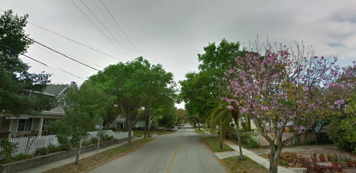
Ocean Drive picture courtesy of the fabulous Matt Ball, street pix from Google StreetView. Thanks!

NOTE: First, the standard Florida warning: in summer, it's HOT! Avoid sun-strokes, and run at sunrise, or in the evenings.

Miami running routes:
South Beach
Coconut Grove

Key Biscayne
For more running routes, see Route List.

I grew up just north of Miami, but moved away before I started running, so I only knew the South Beach as a place to cruise (or in a weirder memory, I was also arrested there once, on Collins Avenue, and spent the night at the Dade County Stockade, but THAT'S another story). But a business trip there a few years ago let me get to know it from the viewpoint of my running shoes, which is a very nice memory indeed.

NOTE: see the Destinations Tips page for tips about spending your free time in this great town!
 
Miami Beach is a long, thin sandbar out across Biscayne Bay from mainland Miami. Almost all of Florida is lined with such protective coastal islands. Miami Beach is almost never wider than a mile (1.6 km), and narrows to a point at the south end (appropriately called South Pointe), where there's an inlet to the Port of Miami, where all the cruise ships land.

The beachfront is all on the east side, facing the Atlantic. The west side was originally swampy, and is mostly built up with faceless condos now, and has no continuous walkways: talk about total lack of urban planning. There are a few bridges across the bay to Miami, including the MacArthur Causeway near South Pointe.
Typical Ocean Drive scene in South Beach, photo by Matt Ball
The South Beach Route
In this route, we'll do what I consider the classic tour of the beach: running Lincoln Road, Espanola Way, Ocean Drive, the South Pointe Marina and back again. We'll start at the heart of Miami Beach, the corner of Collins Avenue and Lincoln Road. Collins Avenue is the main north/south road, also known as route A1A, the Florida coast road. But it's got a lot of traffic, so we'll avoid it.

Let's start by running west along Lincoln Road. This is one of America's greatest pedestrian streets. The whole street has been turned into one great hangout, with a park-like atmosphere and one wonderfully-smelling restaurant after the other and their outdoor tables. It's called Lincoln Road Mall, although it has nothing to do with a typical American shopping mall. This is definitely the place to spend an evening.
Lincoln Road street scene
The nice part of Lincoln Road ends at Lennox Avenue, so turn around here and head back up the other side of Lincoln Road. But we won't run all the way back to Collins Avenue again. At Meridian Ave., turn right and run 3 blocks south to Espanola Way where we turn left, heading east again. This is another great street, semi-pedestrian, with Spanish-style architecture, and a flair all its own.
Espanola Way
When you get back to Collins Avenue, you'll pass Jerry's Deli, one of my favorite places to eat in the world. This is a relict of the New York-influenced past. In the 1970s, Miami Beach was a sleepy place for Jewish retirees from New York. It looked like Coney Island with palm trees: delis and Nathan's hot-dogs and old folks pushing aluminum walkers all over the place. But when Miami Vice made the South Beach cool again, the world's entire jet-set poured in and drove the rents up.

Cross Collins and run just a few steps south, and turn left again on 14th Place. After just 100 meters, you have now entered the famous Art Deco neighborhood called South Beach.

Turn right onto Ocean Drive, and you will have the old hotels on your right, and Lummus Park on your left. On the other side of the park is the beach itself. It's hard to decide where to go here: run by the great old hotels, run through the park, or run directly on the sand. But we'll run back on the sand, so we can save that for later. Enjoy the street theater, there are lots of people around here who are experts at making themselves conspicuous. The most interesting, and loudest, hangout is at 8th Street, the biker bar called Wet Willies.
Ocean Drive at Lummus Park, by Google Maps StreetView
At 5th Street, where the park ends, the street gets less interesting, so we'll turn left and run the 100 meters to the beach promenade, just behind the beach hotels, and turn south (right) again. When you come to the gigantic high-rises, you've just about reached South Pointe. This is a great place to look out at the ships and boats constantly cruising through the inlet. Across the water to the south you can see Fisher Island, Virginia Key, then Key Biscayne, with its lighthouse (see the link above for the Key Biscayne route!).

Turn right, heading west, staying along the water now, heading through South Pointe Park along the inlet. Soon you will come to the marina, full of hundreds of boats peacefully bobbing at the docks. We'll just run along the dock all the way to the end (hey, I'm a sailor, what do you expect?). When you hit the end of the marina, just before the MacArthur Causeway bridge, turn around and head back east along the water.

Now run northwards, up the beach all the way back home, staying on the wet, close-packed sand, near the water. It's hard to tell exactly when you get back to Lincoln Road, but look out for the Loewe's and Ritz-Carlton hotels. When you see them, you're just about home. Just turn left and run back the block to Collins Avenue.

And while you're at it, let's not forget that we're at the beach in Florida: the best thing at the end of a run is to kick off your shoes and jump in for a swim. Even in winter, you can enjoy the water. And there are showers along the promenade to wash off the saltwater. Hope you have as much fun as I did...
The author taking his own advice

Friday 29 October 2010

Utrecht Old Town, Netherlands Running Route

Length: 8 km (5 miles), terrain flat

For more running routes, see Route List.

Ahhhemm... He doesn't know about it yet, but photos for this article are provided by John Moran. Take a look at his amazing nature photography at johnmoranphoto.com

Utrecht is just another typical Dutch town: beautiful old houses lining a network of canals crossed by stone bridges, full of cafes, medieval churches and a vibrant street life. The Dutch have really figured out how to make city life livable. You can spend your entire run just jogging up and down the old-town streets, being amazed at one fascinating spot after another. So why don't we do just that, with a quick tour of the old town. This run isn't so long, but you can easily extend it by running down any extra streets that you please. I added a loop to nearby Grift Park, but that only adds another half-kilometer to the total.
Local consultant team advises the author on scenic routes
The Utrecht Old Town Route
The old town runs basically north/south, at just 2 km long and 0.5 km wide. Two canals, the Oudegracht (old canal) and the Neuwegracht (you guessed it: new canal) run the length of the old town, and it's also surrounded by a moat on the south, east and north sides. The main train line runs along the western edge. Between the train station and the old town is a strip of ghastly modern buildings, throned-over by the soulless Vredensburg shopping center (the west-side moat was covered over for it!!??!!)

We'll start next to Vredensburg, at the central tram station. and then get the heck out of there quick. Just head east on Vredensburg street and in just a block you're suddenly immersed in the beautiful old-town buildings. The street changes its name to Viestraat (cattle street), and then bridges the Oudegracht canal, where you'll see the big main post-office at the corner. Turn right here and just run south. 
Along the Oudegracht canal
Just enjoy the scenery, but watch out for collisions with the many pedestrians and zillions of bicyclists. The canal zig-zags at the old town hall, then we'll turn left on Servetstraat, to run to the cathedral (or "Dom"), which you'll see, looming up ahead of you. The church tower, which you run THROUGH is strangely detached from the church, a block in front.
Hey, share the road! Bikes are everywhere.
We'll run a half-circle in the square in front of the church, then continue for a block southwards on Domplein, then turn right to run the one block back to the Oudegracht canal. Here, we'll turn left and continue southwards for a kilometer until it ends. 

Head diagonally left, towards the bridge over the southern moat, but just before the bridge, turn left onto the path called Manenburg, which runs through the park along the water, where there used to be the city walls. Keep running along the water, and the path makes a left-turn to the north, around the old observatory with the funny white-domed towers.
What a hangout!
We could just continue going straight along the water, in this nice park, which you can do as an alternative. But we'll turn left, circling the observatory to get onto the other north/south canal, Neuwegracht. Like with Oudegracht, you can run on either side of the canal. Turn right at the canal, heading back north. 

This street isn't as lively as Oudegracht, it's more a residential neighborhood. There are a lot of quiet, scenic side streets, so feel free to just turn down one any time to take a look. Eventually, the canal makes a 90-degree turn at Trans street, but we keep going straight, pretty much. The road ahead forks here, and we'll take the more scenic way, Achter de Dom, which runs along the back side of the cathedral. There are some great old houses here. 

When you run behind the church, curve around to the left and then cross the street and continue north on Domstraat. You'll run straight to the next big church, the Janskerk. It sits in a big, empty square, the flower market (flowers are big business in Holland).
Utrecht street life
Hang right at the church, on Nobelstraat, and run out 4 blocks over the bridge on the eastern moat again. Once you cross the bridge, turn left immediately to go north on Wittevrouensingel, which skirts the canal and will take us up towards Grift Park. 

Keep going until the moat and street make a sharp left turn around the prison. You just need to keep going straight into the park across the street. The park is split by a canal (yes, I know, they're everywhere!), but there's a bridge. So do a loop through the park and exit the way you came in. 

But instead of running back the same way again, we'll turn right and continue along the moat on Wittevrouensingel for about 7 blocks, until it runs into the Oudegracht canal again. Turn left here and in 3 blocks you'll see the post office where we first turned onto Oudegracht before, at Viestraat. Turn right here, and you'll be back at the tram station in just 3 blocks.

Thursday 28 October 2010

Berlin Grunewald West Running Route

Length: 15 km (9.3 miles), terrain contains one hill

Berlin Running Routes:
Best Berlin Running Routes: Overview
Historic Berlin Mitte  
Tiergarten park 
Kurfürstendamm, heart of West Berlin  
Prenzlauer Berg, Berlin's coolest neighborhood  
Grunewald West  
Grunewald East

Potsdam Royal Residences
Ode to Berlin: my long-running love affair with this great city 
For other running routes, see Route List. And if you're interested in an essay on what makes Berlin so special, take a look at this Ode to Berlin, written in the transition days after the Wall came down.

Pictures by Karl-Heinz Liebisch at www.pixelio.de 

This route will explore the western side of Grunewald -- the bigger, hillier part -- located between the Avus freeway on the east, and the large lake, Wannsee, on the west. This is a great place for heading out for long runs on summer evenings, racking up kilometers with a few good hills. It will begin at the same place as the other Grunewald run, at the Grunewald S-Bahn station. But this time, we'll take the pedestrian tunnel under the train tracks and freeway to the west side of the Grunewald woods.
Grunewald path
The Grunewald West Route
When leaving the tunnel, immediately curve off to your right, past the beer garden (hey, no stopping here yet!) on Dauerwaldweg, keeping the sports fields on your right. After the surroundings turn into woods on each side, the path runs into the Teufelsseechausee.

There are 2 hills in front of you at this point. Turn right. After 200 meters, turn left onto the road going up through the parking lot, between the 2 hills. Turn right to curve up the steps to the Drachensberg hilltop. This is the place where every kite-flyer in Berlin brings their kites and flies them. There's a great view. You can see the left-over, now unused, American-military listening post on the other hill to the south, the Teufelsberg.
Listeningpost on the Teufelsberg
NOTE: Click on this link to flickr to see an amazing image of the sun setting over Grunewald from the Teufelsberg.

Now, let's run towards the Teufelsberg, following the paved street until you can get onto the smaller hiking path curving around the east side of the hill. The top of the hill is still fenced off, so you can't go to the top, but there are nice views, anyway.

From the hill, run south, getting back on the Teufelsseechausee, toward the pond called Teufelssee (Devils Lake). There's another parking lot and nature center here, as well as a nudist beach, but we're out to collect kilometers, aren't we? So on we go, cutting around the lake on the east side, where the path branches off to the left.
Teufelssee pond
Keep going until you come to the Poststrasse, where you'll see a white milestone. Just keep going straight there, for 2 kilometers going straight west through the woods towards Wannsee. Just before the lake, you'll cross the Havelchausee lakefront road, and come to another hill, the Dachsberg.

Keep going straight, around the east edge of the hill, and you hit the lake. What a great place this! You're suddenly standing on secluded beach, with sailboats out on the lake and woods all around, while you're supposed to be in one of Europe's biggest cities. Now you've deserved a swim, if you want one.
At the Wannsee waterside
This is about the halfway point. Now we'll head north along the lakeside, with the water to our left. You'll soon round a peninsula with a restaurant and marina, and continue along the water, with the road to your right. There is even a bus line out here, so if you feel beat, you can take a bus back to the S9 train station at Pichelsberg. A kilometer after the marina, you'll come to the floating lakeside restaurant, the ship Alte Liebe (Old Love). Here, we'll turn inland to cross the woods again to loop back to Grunewald station.

Just about 100 meters BEFORE the Alte Liebe, turn right onto the road going to the British School. Take the path on the left that goes straight along the left edge of the school and just keep running straight for 1.5 km until you find yourself at the white milestone at Teufelssee again.

This time we'll dispense with running up the hills again, and just follow Schildhornweg all the way to the the train station at Grunewald.

Berlin Grunewald East Running Route

Length: 10 km one way, or 21 km out-and-back (6.2 or 12.5 miles), terrain flat

Berlin Running Routes:
Best Berlin Running Routes: Overview
Historic Berlin Mitte  
Tiergarten park 
Kurfürstendamm, heart of West Berlin  
Prenzlauer Berg, Berlin's coolest neighborhood  
Grunewald West  
Grunewald East

Potsdam Royal Residences
Ode to Berlin: my long-running love affair with this great city 
For other running routes, see Route List. And if you're interested in an essay on what makes Berlin so special, take a look at this Ode to Berlin, written in the transition days after the Wall came down.

Pictures by Karl-Heinz Liebisch at www.pixelio.de

Berlin is a great running city. There are large parks, and the city is flanked by easy-to-get-to forests full of lakes, there's the Spree riverfront and lots of historical places. There are hundreds of great routes.

NOTE: see the Destinations Tips page for tips about spending your free time in this great town!
 
I have to say, Berlin has a special place in my heart: I knew the place when it was still divided by the wall, serving as the imminent ground-zero for World War III. The city was cut off and largely avoided by any tourists. Most people didn't want to live there, and the whole place had to be subsidized by the West-German government. I ran my first marathon here (see the "The Marathon" story to get a feeling for what it was like in those days).

My first time in Berlin, I stayed in Lübars, at the northern-most tip of West Berlin, an area with farms and fields, the only place in West Berlin where you needed to turn on your high-beams while driving. There was no wall around the outskirts of West Berlin, just a fence, or rather several layers of East-Berlin fences. I ran along the fence, fascinated by the watch-towers, the no-man's-land and the occasional foot patrols. I made of game of hiding in the shadows whenever a Volksarmee patrol came by, not that they could do anything to me. Running routes in the city center along the wall, you could climb wooden stairs placed at various locations, where you could look out over the wall into the greyness of East Berlin, a place with no neon and few streetlights.

But those days are long-gone. Berlin has become a normal city with normal urban problems and delights. And then, as now, one of the great running areas is Grunewald, on the west edge of town. The woods is split down the middle by the Avus autobahn and a parallel train line. Both sides of the woods are great to run in. There are hills and lakes where you can swim, and trails everywhere.
Grunewald path in springtime
This article deals with the smaller, flatter, eastern edge of Grunewald. We'll start at the north end, and run down in a southwest slant to end at one of the train stations at the other end. Grunewald is easy to get to, there are a lot of S-Bahn (commuter train) stations and U-Bahn (subway) stops along the whole east edge. We'll start at the Grunewald S-Bahn station, where the S7 stops, at the northern edge of the woods.

NOTE: The route description for the Grunewald West route is found here: Berlin Grunewald West, Germany

The Berlin Grunewald East Route
The Grunewald neighborhood is one of the nicest in Berlin, full of beautiful villas. Even the train station is beautiful. You could spend your run just happily zigzagging around the neighborhood. We'll go down Fontanestrasse a couple of blocks until it runs into Koenigsallee, where we turn right and run straight into the woods after a few blocks.

The road continues on straight through the woods, but that would be a bit boring. So better take one of the left-hand trails leading east to the first lake, Grunewaldsee.

Once you hit the lake, turn left and continue running southwest. This is already the first chance to swim. There's a nudist beach halfway down the beach, and two dog beaches (I kid you not) across the lake. At the south end of the lake, you'll come to the Jagtschloss, the 500-year-old royal Prussian hunting lodge, with some beautiful buildings to look at.
Grunewaldsee
Behind the lodge, at the little parking lot, you'll cross Hüttenweg, and keep running southwest through the woods for another kilometer, and then cross Onkel Tom Strasse (the name is real). After a few hundred meters along some small ponds, you'll hit the next real lake, the Krumme Lanke. If you're there in the summer and feeling like a swim, a little unofficial beach is located right at the head of the lake, on the left. I love just kicking off my shoes and jumping in. There's also another, official, swimming spot at the south end of the lake.
Krumme Lanke in the autumn
NOTE: Click here for a picture at flickr of swimmers at Krumme Lanke.

Wet or not, continue following the lake on either shore, then straight southwest 200 meters to the next lake, Schlachtensee (Battle Lake). There is still another place to swim here, but it's a bit built up. The whole woods is getting narrow here, with houses coming up the east side of Schlachtensee, and the Avus not far to the west. Continue running along the west shore of the lake, with the woods to your right.
Along Schlachtensee
The woods ends at the south end of the lake. We're almost at the end. You can either turn around here and run back, making it a 20-km run, or just take the S-Bahn home from Nicolassee, right around the corner. To do that, you need to keep going south to Spanische Allee, and then go left, under the train tracks, and turn right on Allemannenstrasse, and go straight the 200 meters to the station.

Wednesday 27 October 2010

Brussels Avenue Louise and Bois de La Cambre Running Route

Length: 11 km (6.8 miles), terrain flat

Brussels Running Routes:
Avenue Louise/Bois de la Cambre  
Center Loop 

Old-Town Sights
Atomium/Laeken
EU Quarter/Woluwe Park
For more running routes, see Route List

Photos courtesy of the creative folks at Flickr Creative Common. Thanks!

NOTE: see the Destinations Tips page for tips about spending your free time in this great town!
 
I've probably spent a total of two years of my life in all the trips I've made to Brussels, and I love the place, but I still don't know how to put my finger on the character of the city. Brussels has a jumbled psyche of multiple personalities: it started as a Dutch-speaking town, and the old town looks like any other beautiful Dutch city. Over the years, though, the town was frenchified, and almost everyone speaks French nowadays, much to the resentment of the remaining Dutch-speaking community.

The monarchy also tried to make its stamp on the city: setting up huge palaces, grand parks and impressive monuments all over the place. The city is officially bilingual, disguising the cultural war going on. And on top of the local disputes, Brussels is home to the European Union, NATO and various international companies, giving the place a much more cosmopolitan feeling than its size would ever warrant. It punches above its weight-class with international buzz.
Hotel Solvay on Avenue Louise, photo by zemistor
Brussels is full of surprises. Tiny parks, the old harbor, palace gardens can be discovered in every corner of the city. The main square, Grand Place, is maybe the most beautiful square in the world, and its side streets, like Rue des Bouchers (Beenhouwersstraat in Dutch), lined with quaint old restaurants with open fireplaces blazing homily away have a character all their own. With all this packed into a maze of twisty streets, it's hard for me to explain how to get around.

So I'll take the easy way out, and describe the straight run out into the huge Bois de La Cambre (Kammerbos) forest at the south edge of the city. We'll follow Avenue Louise, a chic, very French-feeling tree-lined boulevard with elegant buildings and a lot of art nouveau mixed in. The route is long though. If you want to skip the run up and down Avenue Louise and just run in nature, take tram line 94 to the end of the avenue, where the woods begin.
Along Avenue Louise, photo by 黃毛
The Bois de La Cambre Route
The route starts at Place Louise on the Boulevard de Waterloo, where you have a view over the old town down the hill. Waterloo is full of lively shopping and restaurants, with a real French flair. Just start running down either side of Avenue Louise.
Tram on Avenue Louise, photo by 黃毛
After a couple of blocks, at Place Stephanie, the trees begin and it takes on a more pleasant feeling. After a while, you've probably had enough of running in a straight line.

So, when you reach the green square where the street takes a slight turn to the right, turn left, running downhill through the little Jardin du Roi park to the park-lined Etang d'Ixelles ponds along Avenue General de Gaulle, where we turn right. Note the many art nouveau homes along this elegant street.

Etang d'Ixelles, photo by Countries in Colors
Follow the park another block, and you'll see the entrance to the old monastery, the Abbaye de La Cambre. The abbey now houses an art school and other institutes. But the beautiful gardens around the backside are open to the public, and you can run through them, looping through to the entrance again. At the entrance, turn left, joining up with Avenue Louise again, just a block away.

Cambre Monastery, photo by Countries in Colors

Cambre Monastery grounds, photo by Countries in Colors
We turn left on Louise to continue running southeastwards, and you can see that the street ends in just a couple of blocks.

From now on, you will be surrounded by nothing but the green forests of the Bois de la Cambre. At first, it's like a park, but soon it is just rolling beech-woods with lots of great paths. There are a few cross-streets, but you'll just need to keep running southeastwards through the woods.

At the park entrance, keep right, then turn left on the Allee des Amazones. This will take you past a theater and a restaurant. The park if fairly long and narrow: if you hit the edge to the left or right, just head back towards the middle again. Eventually, you'll hit the pond, with the Robinson restaurant on the island in the middle. Visitors can only get there via the little ferry at the shore.

NOTE: This is Brussels' most popular running track: you'll find lots of runners who just run laps around the lake.
Bois de la Cambre lake, photo by blesga
I would just say to join the crowd and  run around the lake, and then head back home the same way you came. If you really want to burn kilometers, you'll need a good map or a gps smartphone to guide you through the many kilometers of forest that lies ahead. There's basically no limit on how far you can go. I've done many great marathon training runs out there.
Bois de la Cambre, photo by Vainsang

Atlanta Midtown, Piedmont Park Running Route

Length: 7 km (4.3 miles), terrain contains some mild hills

For more running routes, see Route List.

The Atlanta downtown area is not really my idea of runner-friendly. It's fairly urban and bordered by a wide freeway along the long north/south length of the city center. But, luckily, there are quieter, greener areas just to the east and west where you can run in peace and quiet. 
A garden in Piedmont Park
In the last decades, the Midtown area of Atlanta -- north of the traditional downtown, centered around 14th Street NW -- has turned into a new high-rise center of trade, and you might well find yourself there if on a business trip. We'll take that as our starting point for a pleasant run through residential areas and then Piedmont Park, west of Midtown.

The heart of Midtown lies at 14th Street NW and Peachtree Street NE (NOT Peachtree Street NW located a few blocks west of here!). Peachtree NE is the main north/south street in the downtown area, and it still has a few relicts of Old Atlanta that haven't been ripped down yet and replaced with shiny, sterile high-rises. For example, just a hundred meters south of the intersection you'll find the gracious old mansion housing the Atlanta Women's Club. But somehow the elegant clubhouse looks a bit tentative in the looming shadows of the surrounding sky-scrapers.

The Midtown Route
But no time for mourning here, we're out for a good run. So let's head north on Peachtree NE for just 1 block and then turn right on 15th Street NE, into the Ansley Park neighborhood. Suddenly, you're immersed into a whole different world, full of leafy trees and pleasant homes on hillsides, and little neighborhood parks. You'll probably already feel yourself breath a sigh of relief.

It doesn't really matter which streets we loop around here: the idea is to put on a few miles in this beautiful neighborhood. And the small hills add extra value to your run.

In Ansley Park
Let's curve around to the left on Peachtree Circle, then turn off at the second right on Westminster Drive. I love this street, with the houses rising up the hillside on the left, and Winn Park sloping down into the dale on the right.

At the first chance, run down into the park and loop through it, but keeping up the same general direction. Winn Park ends where Westminster runs into The Prado. But there are 2 little parks across the street that follow the valley, like a chain of pearls.

So cross The Prado into tiny Eubanks Park, then cross Barksdale Drive into Ansley Park. You come up out of Ansley Park at Maddox Drive. We'll turn right on Maddox and run a few steps to Park Drive, then turn right again and follow it south through the neighborhood until we exit at Piedmont Avenue.

Running in Piedmont Park
So now we'll start the second phase of the run, running through Piedmont Park (a real park, not the name of a neighborhood). Cross Piedmont Ave. here and run straight ahead. You are on a hill, with the valley coming up in front of you. The botanical garden is on your right, and the Storza Woods is on your left. I always like to take a loop through the woods and back. There is a trail there, as the only cost-free part of the botanical garden. But you'll have to decide if you like running in a lonely spot like that. I enjoy it, though.

Atlanta Midtown from Piedmont Park
The road curves to the right, past the entrance to the botanical gardens, and stright into Piedmont Park itself. The park was home to the 1895 World's Fair, and was later redeveloped by the guy who planned New York's Central Park. But obviously, a bit less effort was put into Piedmont. It's mainly a rolling lawn with occasional trees, baseball fields and a large pond. NOTE: on a return trip in September 2011, the park had undergone a beautiful restoration, and was looking great.

Let's turn left at the main lawn and we'll lap the pond, Lake Clara Meer. Turn left when the path comes to the lake, and just follow it all the way around, and when you almost get back to your starting point, cross the bridge over the middle of the lake to take you further south to loop through the rest of the park.

Piedmont Park: Lake Clara Meer
Run through the open lawns a the south end of the park until the park ends at 10th Street. Then follow the path back west along the road, heading back up towards Midtown. Just go straight on 10th Street (I actually like exploring the quiet, hilly neighborhood just south of here, and run up 8th Street). You'll go by the Flying Biscuit Cafe, with the best breakfast food in existance.

After a few blocks you'll run back into Peachtree Stree NE, where you turn right and run north the few blocks back to the starting place.

Tuesday 26 October 2010

St. Petersburg Bayside, Florida Running Route

Click here for route map
Length: 12.5 km (7.8 miles), terrain flat

Tampa Bay running routes:
St. Pete Bayside
Tampa Downtown
Pass-A-Grille Beach
For more running routes, see Route List.

Extra pictures courtesy of Google StreetView. Thanks!

The great thing about running in St. Pete is that it's a peninsula between Tampa Bay to the east, and the Gulf of Mexico to the west: you can run while watching the sunrise over the bay in the morning, and later that evening you can watch the sun set over the Gulf. I lived in St. Pete for three years, and have run about everywhere in town, back when I was an editor, then a writer for the Sunday magazine at the St. Pete Times. I get back as often as I can to this relaxed town.

Central Avenue in downtown St. Pete
NOTE: see the Destinations Tips page for tips about spending your free time in this great town!
 
A word of warning: Florida is hot and humid. Even in the winter, you can overheat quickly. It's best to run in the early mornings before it has heated up too much. And in the summer, you can hardly run without stopping to jump in the water for a swim. But even that's not much help: you can sweat while swimming, the water is so warm!

This route is what I consider the classic route in town, going from downtown, north through the scenic North-East section, then on through the mansions of Snell Isle, and back. Downtown St. Pete has gone through a wonderful metamorphosis in the last decades.

Pelicans at the St. Pete Pier, my own photo
When I first moved to town in 1980, it was a place for retirees from Ohio and Michigan with little money. The rich ones moved to exclusive retirement communities with attached golf clubs elsewhere in Florida, the poorer ones came to St. Pete and its shuffleboard club and cheap boarding houses. The biggest attraction was Webb's City, the "world's biggest drugstore" and its dancing chicken. The only other businesses were 5-and-dime stores like McCrory's and Kroger's, and their soda fountains, caught in a time warp from the 1940s.

Now, the boarding houses have been bulldozed, and new businesses, restaurants and apartments have attracted a much younger crowd to the downtown.The latest recession pounded Florida in the solar plexus, but the businesses are flourishing again.

The Bayside Route
So that's where we'll start, right downtown at the waterfront, at Pioneer Park, at the corner of Central Avenue and Bayshore Drive. The bayside waterfront is beautiful along the whole stretch, so you can't go wrong here. We'll head north, with the water to the right side. The yacht club sits next door to Pioneer Park, and then we'll run past a marina on the right.

The bayfront
After a couple of blocks, we'll cross 2nd Ave. NE, with the St. Pete Pier out in the water. If you haven't been out there yet, you might want to take a little loop out around the pier, adding an extra kilometer to the run. There are lots of pelicans hanging out, and fishermen trying their luck, and you get a great view of Tampa Bay.

NOTE: The city has demolished the old inverted-pyramid pier building, and it is being replaced by a new one, scheduled for opening at the end of 2019. Until then, the pier is closed for construction.

We'll keep running north on Bayshore, past the classic Art Museum and Straub Park, with more yachts on our right side.

The Vinoy Hotel
The street ends at the old Spanish-style Vinoy Hotel, where we turn right and continue along the water on 5th Ave. Soon the route goes through a chain of several waterfront parks: Vinoy Park and then North Shore Park. There's a decent beach at North Shore, so you can already jump in the water if you're feeling overheated. I always swam here in the summer at the mid-point of my runs.

Along Coffeepot Bayou
To the west (left) of the park is the picturesque Historic North East Section, which we'll run through on our way back. The houses lining the park get bigger and nicer as you continue to the end of the park, where it curves to the left, along Coffee Pot Bayou. Out in the bayou, a little jungly island is always full of white ibises.

Keep running along Coffee Pot Boulevard until the old draw-bridge leads you across the bayou to the right, off to the mansions of Snell Isle. Immediately after the bridge, turn right on Brightwaters, and stay on this beautiful street full of waterfront homes as it zigzags along the bayou arms.

The bridge over Coffeepot Bayou
If you stay on Brightwaters, it will eventually dead-end, where you turn around head back to Cordova Blvd., and turn right.

Brightwaters isn't so bad, either
In just a couple of hundred meters, turn left at the first turn, Snell Isle Blvd., and follow it back towards Coffee Pot again. The street does a 90-degree turn at the golf club and then heads out over the draw-bridge again after about 6 blocks.

Homes along Brightwaters
On our way back, we'll leave the waterfront and cut through the North East section. After crossing the bridge, go straight for a block, where the road curves to the right on 21st Ave. Run 2 blocks to Locust, and then turn left, going south.

Along Locust Street
Just run straight through this leafy, unpretentious neighborhood till it dead-ends into 9th Ave. I used to live right down the block, here.

My old place: hey why did I ever leave?
Go left for a block to Beach Drive, where we turn right and head straight back, past the Vinoy again and along the other side of Straub Park, with its magnificent banyan trees, till we find ourselves back at Pioneer Park again.
The banyans along Straub Park

Monday 25 October 2010

Oslo Center, Norway Running Route

Length: 8.5 km (5.3 miles), terrain flat

Oslo running routes:
Oslo Downtown route
Oslo Bygdøy island route

Oslo Tryvann wilderness route
Oslo Fornebu fjord route
Oslo Sognsvann lakeside route
For more running routes, see Route List.

Pictures courtesy of Google StreetView

NOTE: see the Destinations Tips page for tips about spending your free time in this great town!
 
If you like the outdoors, you'll love running in Oslo. Like all the other Scandinavian capital cities, the town has a close-to-nature, provincial character, with lots of natural scenery to run through. With its location at the end of Oslo Fjord, there are sweeping views of the water and its many islands, and mountains rise up right behind town. You can choose flat trails along the waterfront, or run straight up a mountain, if you please. You can run out onto peninsulas or even take ferries out to several islands and run there. And for you trail runners, you can even take the tram up to Frognerseteren at the TV tower and then just run north into absolute wilderness, full of wooded mountains and lakes.

The Central Oslo Route
This route is what I consider my basic Oslo route, looping through the old center of Oslo, taking in all the basic tourist sights: the royal palace and its park, the main, park-lined boulevard with its university, theaters and the parliament, then discovering the old admiralty buildings at the waterfront, the fort, the redeveloped harbor with its windjammers, ferries and restaurants, then returning by the famous city hall. All that in one normal jogging distance of about 8 km.
Karl Johans Gate
We'll start in the heart of the city at the intersection of Karl Johans Gate ("gate" means street, and not gate) and Rosenkranz Gate. The Grand Hotel is right there, and though you probably won't be staying there, this is definitely the spot to be. Karl Johans Gate is the town's main boulevard, stretching from the royal palace up on the hill to the west, to the main train station to the east. The Parliament (the Storting) is just diagonally across the street from our starting point, and the street is lined by a pleasant park on the other side.

We'll first run up to the palace, which you can already see throning upon the hill, and then come back down the other side of the street.

So off we go, heading west on Karl Johans Gate, with the park on our left side! It's just two blocks to the palace grounds, with the old university buildings on the right.

Keep going straight up the drive to the palace: it's open to the public, even in the evenings. You can jog a loop around the palace, through the park, and come back out in front again.
The palace grounds
Once back at the palace entrance again, head back east down Karl Johans Gate, through the park this time. The Norwegian National Theater is the first building on the right, then, at the Storting cut back onto Karl Johans Gate, which becomes a pedestrian street, the main area for nightlife in Oslo. After 4 blocks you'll see the old cathedral on the left.

Now it's time to head to the waterfront. So turn right on Kirkegata (Church Street), right at the front of the cathedral. You'll run through 4 blocks of unspectacular downtown buildings, but then you'll come to the leafy square in front of the Mint, on the right. After another block, there is another nice old square on the left side.
Bankplassen at the Mint
After another block straight on Kirkegata, you'll come to the gate of the old Norwegian naval headquarters. It all looks like a military museum from 200 years ago (part of it IS a museum), but most of it is still in use by the navy). Hopefully, the gate will be open and you can loop through it. It's not too big: just a few buildings. Otherwise, turn right and go right to the Akershus fort, just 150 meters away. Akershus is a fascinating fort/castle built up over the centuries.

If you're not too late, you can just jog inside, there's no entrance fee. If the gate's closed, you'll just have to loop around it from the outside. There is a collection of castle buildings, cannons and lookout vistas from the fort walls inside, and real sentries who watch over this still-used military base.
Entrance to Akershus
Exit at the same spot where you came in (or if you couldn't get in, you're still there!) and go south, towards the water on Kongens gate (King Street). The waterfront begins just past the end of the fort.

Turn right and run beneath the castle walls, where the cruise ships and visiting naval ships dock up. I always enjoy jogging out onto the docks to get a close look at the the windjammers that are always found there.

At the north end of the fort, the waterfront curves away to the left. Just keep following the water. Here, in the old harbor, there are lots more windjammers at the docks. The route curves around the northern tip of the harbor, and here is the ferry landing for trips to the various fjord islands (that's another route description!).
Aker Brygge
You're now entering the Aker Brygge harbor redevelopment, full of shops, restaurants, a marina and tour-boats. You can continue running out to the end of the harbor promenade, and then either turn around and run back to the ferry landings or loop behind the buildings and run back that way (I like being on the water).
Looking back from Aker Brygge: Akershus across the way, city hall on left side
Once back at the ferry landings, you'll be looking straight at the looming city hall building (Radhus), with its twin brick towers. Let's run over and take a look at this architecturally acclaimed building. The shape is typically Scandinavian modern. But the part about it that I like is the amazing detail-work put into it, whether the brickwork itself, the windows, the statuary, everywhere you look you'll see great craftsmanship.

You're looking at the back side now. So run straight ahead to look at the other side and the main entrance. Go up to the entrance and then wander down the arcade walkways to either side. They are lined with carved wooden scenes from Norwegian sagas from the Viking times.

We're just 2 blocks from where we started from now, so turn your back to the town hall and run straight the one block north to Karl Johans Gate and you'll see the starting point one block to your right.

Sunday 24 October 2010

Paris, Canal St. Martin, France Running Route

Click here for route map
Length: 6.5 km one way, 13 km out-and-back (4 or 8 miles), terrain flat


Paris Running Routes:
Best Paris Running Routes: Overview
Seine island of St. Louis, St. Paul, botanical garden  
Left bank and Luxembourg Gardens 
Paris' green heart: Bois de Boulogne   

Canal St. Martin  
Montmartre/Pigalle
Rock formations of Parc Chaumont  
Seine loop with Champs Elysees and Eiffel Tower  

Seine riverside run 
Bois de Vincennes 
Versailles Palace Gardens 
La Défense/Nanterre 
Saint Germain 
For more running routes, see Route List

Pictures taken from Google StreetView Thanks!

I enjoy running in Paris, seeing all the beautiful sights while zig-zagging through the often elegant and fascinating neighborhoods. But Paris isn't really a very running-friendly city. The parks are small, and mostly closed in the evenings, and the Seine River has busy streets along both banks most of the way. Only the Bois de Boulogne, on the west edge of the city (and Vincennes in the east) provides any large doses of nature. So I was pleased to discover a route along the St. Martin canal a few years ago, when I had to work in the otherwise not-very-scenic La Villette neighborhood on the north edge of town.
Canal St. Martin at La Villette, with Cité des Sciences in back, at left
Canal St. Martin Route
A north-south route like this (no loop) poses you with the decision on how to get back: run back the same way (at least you can run back on the other side of the canal), or continue home on the Metro. You'll have to figure that out yourself, but there are Metro stations at each end of the route, as well as others along the way. We'll start at the north end of the route. You can take the the M7 Metro to Port de la Villette.

This starts you at the amazing Cite de Sciences complex, which I'd never heard of until I worked next door. In typical French futuristic fashion, the whole complex of buildings is simply fascinating. 
The Cite de Sciences, with IMAX dome
Getting out of the Metro, facing the Cite de Sciences exhibition hall, run around the right side of the building. This puts you on a footpath that crosses the canal on the back side of the building, with the spherical IMAX theater and a submarine in the courtyard. Jog across the footbridge to Parc de la Villette, where you can do a loop through this fanciful park. (Note: if the footbridge is blocked for any reason, just jog along the west bank of the canal, with the water on your left-hand-side.)

But if you cross the canal on the footbridge, and loop the park, you then head southwest along the canal, with the water on your right side.
Bridges and locks are everywhere
Run southwards along the canal for about a kilometer, and you'll come to the Rotondo, a classical-looking ex-customs house, and a few new restaurants, cinemas and clubs that they recently built along the quai. The Jaures and Stalingrad Metro stations are both also located here, on the elevated Metro tracks.

You can continue running along this pleasant canal, with its scenic bridges and quiet side-streets. The section after the Rotondo is my favorite. There are a collection of locks and pedestrian bridges spanning the canal after it takes a turn to the left, near the Gare de l'Est train station.
Pedestrian bridge over a lock
At Rue de Faubourg, though, the canal goes underground, and is replaced by a narrow park for the next 2 kilometers. If you look closely, you will see round openings at regular intervals to the canal below, from the days when the canal wasn't lit with electric lights.
The underground canal becomes a park
It ends up at the Bastille square, where you can take another Metro home, or continue for a few more blocks until the canal runs into the Seine, across from the botanical garden. Or just switch sides of the canal and run back to La Villette. And voila: one of Paris' hidden delights is now one of your jogging routes.