Length 8.9 km (5.5 miles), terrain: one hill, gain 83 meters
NOTE: This route gets pretty muddy after a rain. If you value clean shoes, try something else, like the footpath along the Jubilee River!
Slough has a reputation of being one of the least appealing towns west of London. It's close to Heathrow, meaning a lot of high-tech companies have set up headquarters there, but the town itself seems a bit loud and run down.
If you're staying in town, you might think you're surrounded by a really boring example of urban grunge, but along the west- and south side of town there are some great running routes through fields and villages, and along the Jubilee River.
This run will take you through the extreme west end of town, out in the village of Taplow. If you're without a car, just jump on a 75 bus heading west down Bath Road.
You could get out right at Taplow, at Berry Hill -- just east of the Thames River -- but we'll go a bit farther west and take more scenic, quiet trails through Taplow. So let's start the run in the most appropriate spot, at Maidenhead Bridge. This let's you view the Thames, and its islands and wharves before you get going. And the stone bridge itself is scenic, over 250 years old, with elegant arches spanning the Thames.
 |
| Start of the run, at historic Maidenhead Bridge |
You'll run past wharf buildings on the left side. At the last building, as the road curves to the right, turn right onto the public footpath that heads into the fields. It soon crosses the Jubilee River (created to reduce flooding on the Thames, and runs along the whole southern edge of Slough), then the path heads uphill towards Taplow.
 |
| Crossing the Jubilee River on the footbridge |
 |
| One of the amazing trees on the hill |
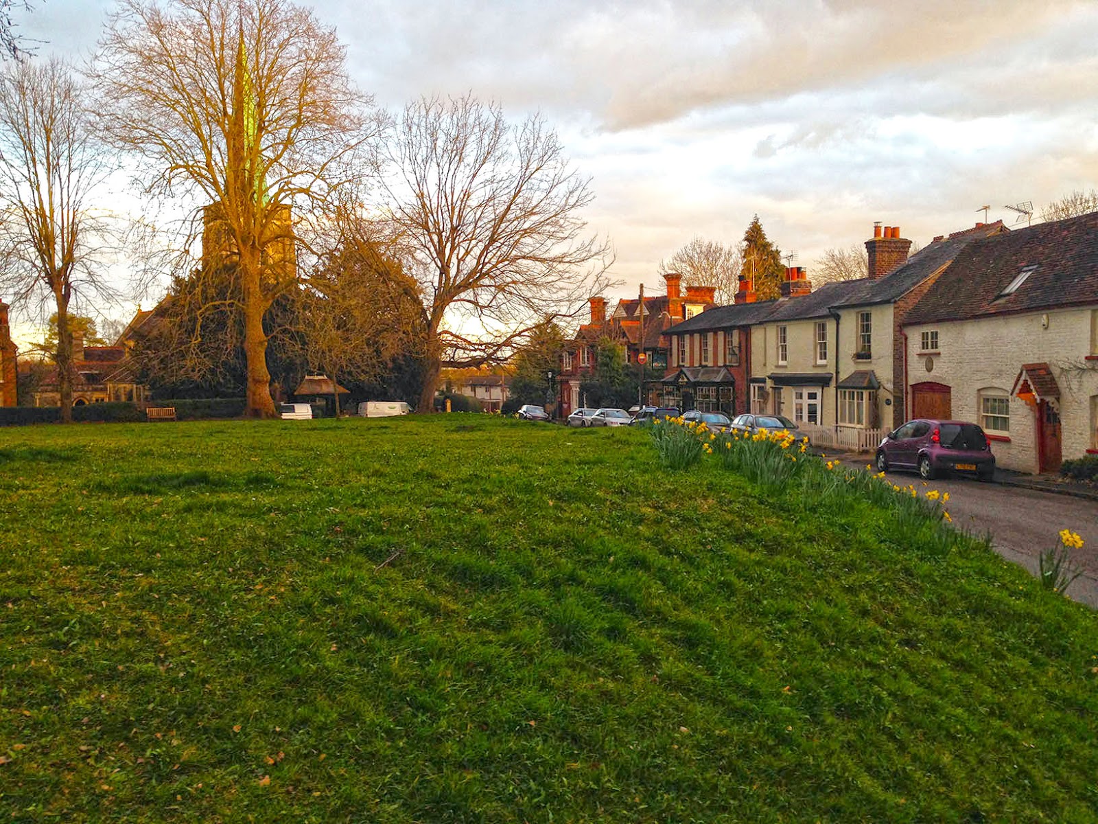
Now turn left and keep heading uphill along Berry Hill. You are now in the scenic village of Taplow, which we definitely want to tour.
So turn onto the second real street on the right, Rectory Road. In a few blocks, you'll come to the heart of the village, the little village green bordered by all the town's important institutions: the pub, the church, the Village Centre and the school.
 |
| Taplow Village Green |
 |
| The churchyard portal |
 |
| The crooked house |
High Street curves to the right and then ends at Hill Farm Road at the 2-km mark. Turn left and continue running uphill, towards the north past more scenic old houses.
 |
| Along Hill Farm Road: typical Taplow |
At the first side street to the right, turn there, onto Hunt's Lane. This little road is lined with big homes and fields. Unfortunately, after a good rain, a small lake totally blocks the road, and you have to tip-toe past the thorn-bushes on the left side.
 |
| Lake blocking entrance to Hunt's Lane |
Horses also use this trail, so it is pretty torn-up in spots, and it's also pretty muddy and slippery. Prepare to run slowly and to see your shoes amass an ever-thicker coating of mud.
 |
| The trail along Hunt's Wood: nice country! |
After one kilometer, the dirt trail ends at a little paved road, Huntswood Lane.
NOTE: You could turn left here and soon come to the Cliveden (pronounced "Cliffden") estate, an imposing palace throning on a bluff above the Thames River, with a beautiful grounds full of trails. The place was home to dukes, earls, counts and later to the super-rich American Astor family. Now it's owned by the National Trust and is open to the public. Unfortunately, you have to pay over 10 pounds to get onto the grounds, and they close at 5:30 p.m. every day.
Turn right here to enjoy Huntswood Lane lane for a bit, lined by a wooden fence and heading through the woods. It passes a little golf club on the right. Soon, after just a half a kilometer it ends at a loud road, Taplow Common Road, at the 4.5-km mark. Now turn around and follow your way back the same way that you came.
No comments:
Post a Comment