Length 9.7 km (6 miles), terrain: lots of little hills, gain 200 meters
NOTE: There are a few interesting variations to lengthen or shorten this route. You could lengthen it another 2 kilometers by continuing up the canyon to tram stop 9 before turning around. And you could remove the least scenic section at the beginning by starting at tram-stop 1, shortening the route by 3.9 kilometers. You can even cut the whole thing in half by taking the tram up the canyon and just running back down again.
HEALTH NOTE: This is the desert. The time to run is early mornings, or make sure you run it in the season from autumn through spring.
The steep, forbidding Santa Catalina Mountains loom above Tuscon's Catalina Foothills. The range is a huge wilderness area, with lots of recreational opportunities for residents and visitors as well. The highest peak in the range, Mt. Lemmon, rises over 9,000 feet, making it the most southern ski resort in the country.
 |
| A runner heading up the canyon over one of the bridges |
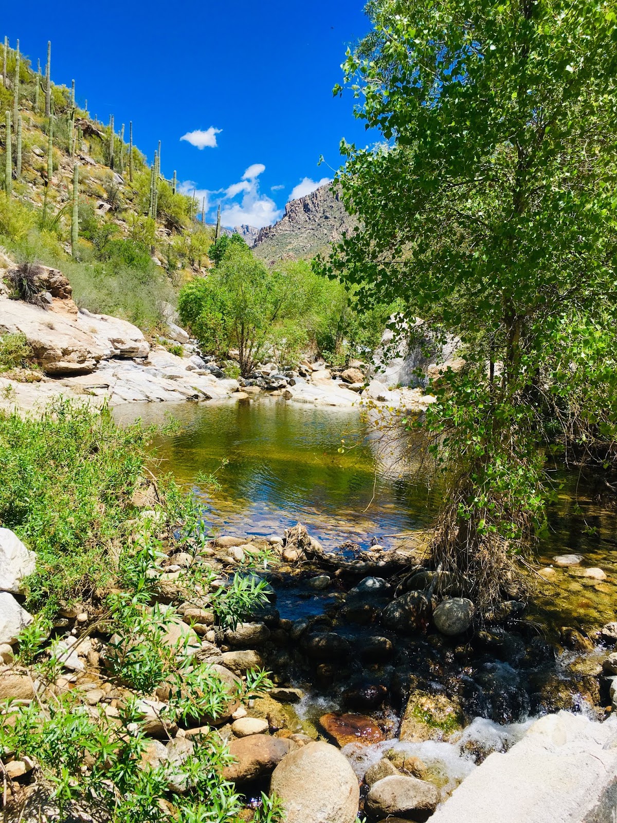
 |
| A Sabino Creek pool |
 |
| Cactus along the canyon walls |
The park is open from dawn till dusk, and there is an entry charge. If you want to take the tram, you have to pay extra for that, but you can jump on and off as you please. There are a variety of toilet houses and a couple of water fountains along the way, as well as the various swimming holes you might want to jump into when the going gets hot. You can park at the visitor center and you can also take the tram from there, or head directly up the walkway next to the road into the canyon.
 |
| Despite the warning, you probably won't see any mountain lions. But keep a lookout for other wildlife! |
So, assuming you're going to run from the visitor center up to tram-stop 7 and back, get yourself to the west side of the center, where the trams load up, and start running northeastwards, up the walkway along the right-side of Upper Sabino Canyon Road.
This is the least scenic part of the run, flat and there are a few side-roads and other trails branching off.
 |
| Anderson Dam is a favorite swimming hole up-canyon |
After a mile, you enter the canyon itself. The road approaches the creek, curves to the left and goes by a nice little waterside picnic area and a water fountain.
You'll then cross the first stone bridge (very clever how they built them low so that flood waters can just flow over the tops instead of sweeping them away!) The first tram stop waits around the next corner.
 |
| Another pool along Sabino Creek |
You'll pass one tram-stop after another. Most are near a bridge, with a pool and maybe a beach.
When you get to tram-stop 7, the Sabino Historic Trail heads off to the right, leading uphill. This is our turnaround point, unless you want to extend it to the final tram-stop, number 9, along the steeper stretch of road.
Even at stop 9, it's possible to keep going up-canyon, but the road ends and you need to follow a rough trail switchbacking steeply up the mountainside, through the cactus.
On the way back, find a good swimming hole to kick off your shoes and have a good cooling off!
 |
| The author taking his own advice |
No comments:
Post a Comment