Saturday 6 November 2010

London Heathrow, Harmondsworth Moor Running Route

Length: 4.5 km (2.8 miles), terrain has light hills


London Running Routes:
Best London Running Routes: Overview
Thames Embankment
Docklands-LimehouseRegent's Canal and Camden Town  
Hampstead Heath  
3-Parks Route: Hyde Park, Green Park, St. James' Park  
Regent's Park  
Hyde Park   

Chelsea
Heathrow Harmondsworth Moor  
Greenwich 

Richmond Park
Notting Hill
Victoria Park
Wimbledon Common Trail Run
Royal Docks/ExCeL Route 
Kew / Brentford Thames Run  
For more running routes, see Route List. 

If your company hates you so much that they book you into airport hotels, you should probably just sit down and cry right there, wherever you are at this moment. A whole world full of great towns and countryside is just waiting to be explored -- and there you are, squeezed between freeways, jets thundering overhead, and diesel fumes lingering in the parking lots of those bunker-like structures euphemistically called hotels.

NOTE: see the Destinations Tips page for tips about spending your free time in this great town!
 
My new employer was obviously trying to tell me something that I don't want to hear when they sent me off to stay at the Sheraton Heathrow on my very first week of work this past week. London -- the most fun-, interesting-, greatest city around -- was just a stone's throw away, but I was stuck out at the airport.

Making the best of this disaster, I went running in the green area just behind the hotel, north of Heathrow, and to my complete surprise, I found (relative) paradise. Harmondsworth village is just separated from the hotel by one field. And there is rolling parkland stretching west of the village, called Harmondsworth Moor, full of public footpaths, streams, hills, lakes and swampy ecosystems.
Harmondsworth Moor pond
The park is hemmed-in by the M25 motorway along its western edge, the M4 to the north, and the A4 (Bath Road with the hotel) on the south. The park was created in the year 2000 on an old landfill, and they did a decent job of bringing back nature here. The only problem is that it's LOUD, with the nearby freeways and non-stop jet takeoffs. Deaf people will think it's true paradise, but the rest of us can fake it. For a few morning's runs, though, it's a welcome surprise.
The Wraysbury River flows through the park
And the Harmondsworth village center has a real pub (the Five Bells, plus the less scenic but just as friendly Crown across the street), a beautiful old church with its churchyard full of hulking old yew trees, and even a manor-house of sorts, Harmondsworth Hall, which is a guest house now, for those few privileged people who know better. All of this will cease to exist when runway 3 gets built. Public protests have fended it off for now, but the village is living on borrowed time, as the regulars will sadly tell you if you spend an evening in the Five Bells, which I would heartily recommend.

If you're staying at the Sheraton Heathrow (don't mix this up with the GOOD Sheraton, the Skyline, down at the other end of Bath Road -- route A4), just follow this route to running heaven. Other hotels such as the Thistle, Heathrow Lodge, Arora and Holiday Inn Bath Road are also close to this route:

Heathrow Harmondsworth Moor Route
Walk out to the street in front of the Sheraton Heathrow Hotel, and just turn right, and run westwards to the end of the hotel property (the parking lot). Right there between the parking lot and the next building, there's a little paved footpath heading north to your right. Head up the footpath. The building on the left seems to be a prison (although it's hard to distinguish from the other airport hotels). Just run up the path, but watch out for the squashed rat! An open farm-field will soon open up on your right, behind the hotel.

After the field, the path goes through a green gate and then splits the village recreation fields. Turn left at the gate and run diagonally across the green lawn towards the northwest corner of the park, keeping the houses to your right. You'll see another green gate between the last rows of houses. Follow the street until it runs into a little road after just one block, Moor Lane.

Now, turn left on this road and you'll run straight into the moor, about a kilometer ahead. Ignore the 2 different barriers in the street, including the blocked bridge, just keep going straight on the footpath. You'll pass some foot trails that cut off to the left and right at various times, going to several parts of the moor, but we'll ignore them. You'll hear the M25 motorway straight ahead getting louder. The road ends at a wooden fence where a wooden waymarker points to Joan's Bridge to the south (left) or West Drayson village just 1.5 miles to the north (right).
Waymarker to Joan's Bridge
You could go either direction here. Let's go south, following the sign towards Joan's Bridge. There is a ridgeline along the west side, close to the motorway. You can use it for some hill work. It's less noisy to stay down closer on the left, though, following the Wraysbury River, with its swamps and pond. When you see the wooden bridge over the river, cross it, and turn back north again, heading back towards the waymarker. Back at the waymarker, you could head back to the hotel from here or continue going north to do a loop of the north end of the park first. Decide on how much distance and time you have.
Along the ridge
As a historical note, the big granite blocks that you see scattered around the landscape are left over from when they tore down the old Waterloo Bridge in 1935. Too bad that they couldn't think of anything better to do with them.

When heading out Moor Lane back to the village, instead of turning right on the first street, back to the recreation field again, keep going straight into the village to take a look. In just a few blocks you'll see the Five Bells pub on the left. Turn left there and you'll find the old church right behind it, and its ancient churchyard (Mr. Cox, who bred the tasty Cox apples is buried here, I'm told). The church is very English: built of split flintstones, with their glassy surfaces reflecting the light, and a solid oak portal at the front door. The churchyard is full of impressive deep-green yew trees.

The Harmondsworth village green, churchyard in background
So now that you know where the pub is so that you can get a decent beer this evening, you can head home. Cross the street, going through the tiny square in front of the pub, and continue down Summerhouse Lane, the side-street next to the little Gable Stores grocery. You'll run past Harmondsworth Hall on the right (remember? that historic hotel that your company's travel agency people book for themselves, so there's no room left for you) and then into a suburban neighborhood. The street will curve to the right, but just go straight on the footpath between the houses. You'll soon be back at the recreation fields, where you turn right and follow the path right back to the hotel parking lot.
In the Harmondsworth Hall guest parlor: is this an airport hotel?
NOTE: As an alternative, when running out towards the moor from the village, you can turn right at the waymarker pointing to "The Ring". This way circles clockwise around the north end of the village, and ends up back in the village churchyard. Follow it north, cross the wooden bridge to Saxon Lake, and then follow the path to the right, along the south shore of the lake. At the east end of the lake, the path turns southward and heads directly back to the churchyard. 
Saxon Lake at sunset

Tuesday 2 November 2010

Flensburg Fjord, Germany Running Route

By Jessica Hauser

NOTE: My daughter, Jessica, was a student in Flensburg, and she sent in her favorite route in that beautiful old Baltic bi-lingual harbor town on the Danish border. It's one of the few runs where you can run over an open border, where people speak 2 languages.

Click here for map
Length: 5 km (3.1 miles), terrain flat

For more running routes, see Route List.

Flensburg is the northernmost city in Germany. It lies on the Flensburg Förde, which is a long fjord that eventually leads to the Baltic sea. This run takes you along the Förde, right across the border to Denmark without you even having to take your passport.

The Flensburg Fjiord Route
The route starts north of the town centre. You can get there on the No.1 bus towards Krusau/DK from the centre in about 10 minutes. Get off at the stop called Ostseebad, and head east towards the water. There are several walking paths leading down to the beach.
Ostseebad beach
From here, there is a beautiful walkway going along the water towards the next beach, Wassersleben. Next to this walkway is a small woods, through which you can also run a little loop.
Along Flensburg Fjord
At Wassersleben, there is a paved pedestrian way going all along the beach. When you get to the end, there is a small street branching off to the right. Before you know it, you've crossed the border to Denmark - there isn't even a sign indicating it. This street now keeps you jogging along the Förde and it soon turns into a wide, unpaved walking- and cycling path. Again, there’s water to your right and woods to your left. You can stay on this path for quite a while, and I normally turn around at some point. If you keep jogging, you'll come past some cute Danish villages, which might be worth the effort.
Wassersleben
When you head back to Wassersleben, and the weather is nice enough, the best refreshment is taking a swim in the Förde before you jump back on the bus. There is a bus stop right at the beach, but you can also keep running a bit further north, to Kupfermühle (copper mill). This is a cute little town that was founded in the 17th century, when the Danish king built a hammer-mill there. The old workhouses are still there today and there is even a copper mill museum.

In Kupfermühle you can catch a bus back to the center of Flensburg.

Sunday 31 October 2010

Hong Kong, Bowen Road Running Route

Click here for route map
Length: 9.5 km (5.9 miles), terrain hilly

Hong Kong running routes:
Hong Kong, Bowen Road midlevels run
Hong Kong Peak Trail route

For more running routes, see Route List

Pictures taken from Google StreetView Thanks!

Hong Kong is a definite trip. They say that New York is the city that never sleeps, but Hong Kong doesn't even stop for a 10 minute coffee break! Everywhere, you'll find yourself pushing through masses of people and traffic. No buildings seem to be smaller than skyscrapers. Private space is practically nonexistent: you'll see people practicing Tai Chi in stairwells, just because that's the only halfway private place they can find. The main part of the city -- the Central District and Wan Chai on Hong Kong Island -- is squeezed into a narrow strip of land along the north coast of the island, with a mountain rising directly behind it, the Peak. Every piece of available land with the footprint for a single-family home has a 30-floor building soaring up from it.
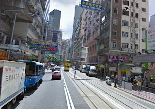
Wan Chai
Welcome to Wan Chai
NOTE: see the Destinations Tips page for tips about spending your free time in this great town!
 
Even in the evenings, the streets are full, with every second doorway occupied by a friendly hole-in-the-wall restaurant with its plastic chairs and tables spilling out into the sidewalk. Even small Hong Kong Park seems only to exist as a background for a horde of wedding photographers busily lining up newlyweds in conveyor-belt fashion. This is definitely a captivating, hard-working, even mesmerizing place! And totally exhausting...

So, after a few days of running through the mobs, you'll find yourself aching for some nature and quiet. That's why Bowen Road has become the city's main running track. This level, semi-pedestrian road lies up on the hillside, in the Mid Levels, parallel to the strip of city below it. There are various access points, depending on where you're staying.

Bowen Road runs from Magazine Gap Road in the west, in the Central District to Stubbs Road in the east, in Happy Valley near the horse-race track (the Hong Kongers are big gamblers!). Bowen Road itself is only 4 km long. You can also easily access it from Wan Chai by slogging straight up Wan Chai Gap Road, which bisects Bowen Road in the middle.

The Bowen Road, Mid-Levels Route
I will assume that you want to start at the Central District end, though, so we'll begin on Cotton Tree Drive, at Hong Kong Park. This is right near the lower station for the Peak Tram (that's another great route, if you stay on the weekend!). The Citibank and Bank of China towers are looming up across the street.

Cotton Tree Drive
Cotton Tree Drive, with Hong Kong Park to left side
The beginning is simple to describe: just keep running uphill. You'll see the Peak straight ahead, so just follow your nose. This is the hard part of the run, but think of it as a great training opportunity. Just follow Cotton Tree Drive uphill, where it becomes Garden Road, then does a serpentine to the left, becoming Magazine Gap Road.

You'll pass a white classical building below, on your left, and see Bowen Road splitting off immediately on the left side. Take that turn!
Turn onto Bowen Road here at the little street on the left
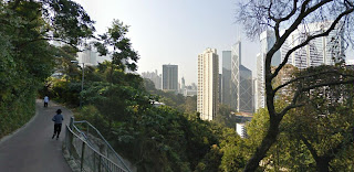
Once on this quiet road, you've got a flat, tree-lined route with a great view over the city for the whole run. Suddenly, you're immersed in a whole other world, with jungles, vistas, woods. It's a little paradise just above the loud city life below. 
Welcome to Bowen Road
Interesting view? Welcome to Bowen Road!
There are a few houses and cars along this 1-lane street, but it definitely belongs to the joggers and dog walkers (not necessarily in that order).
The eastern end of the road is basically car-free. Just keep trucking, enjoying the jungle and the constantly changing views.
A dog-free section of Bowen Road
After 4 km, where Bowen runs into Stubbs Road, you can turn around and head home again the same way that you came.

NOTE: If you want, as an alternative way back, you can turn down Wan Chai Gap Road and run straight down to Wan Chai, for something different. At Kennedy Road (another tree-lined mid-levels road, running parallel to Bowen Road), you can then turn left head back towards Hong Kong Park.