Length: 8 km (5 miles), terrain hilly
Düsseldorf Running Routes:
Königsallee/Altstadt/Rhine
Gerresheim hills
Both Sides of the Rhine
Rhine Harbor Route
Stadtwald forrest run
See the other running routes here!
Düsseldorf is a medium-sized city, with a variety of great jogging routes. You can head along the Rhine River, head through the beautiful beechwood hills of the Stadtwald forest, or find similar country in the Gerresheim neighborhood, on the north edge of the city. I like Gerresheim because it combines a beautiful village center with wooded hills and valleys just east of the neighborhood.
 |
| Typical ravine in the beech woods near Gerresheim |
You'd never guess that you are on the edge of a real city. Gerresheim was once a separate village, and it still preserves some of the small-town feeling. I was back in Düsseldorf a couple of months ago, and the idea of running in Gerresheim pulled me there like a magnet.
Gerresheim Route
GETTING THERE: You can get there easily by taking the 703 streetcar, or even the S-Bahn commuter train, if you don't have a car. If you take the 703 streetcar, get out at Gerresheim Rathaus (town hall). You are then right there in the center of the village. The 709 and 713 streetcars also go to Gerresheim, but then you have to get out at Gerresheim Krankenhaus, the end of the line, and jog a kilometer down Gräulinger Straße.
From the Rathaus, jog the 2 blocks eastwards down Neussertor to the old, romanesque St. Margarete Church. There is a beautiful, quiet old square on the south side of the church.
 |
| St. Margarete |
 |
| Head straight across this square |
 |
| Gerresheim market boules players |
Turn in here, just before the gravestones, and jog the path up to the top of the hill. The last part is pretty steep! At the top, you'll come out to a farm field with a tall radio tower on the hilltop. Note down its silhouette: that cylinder-shaped tower will be your landmark to help guide you home.
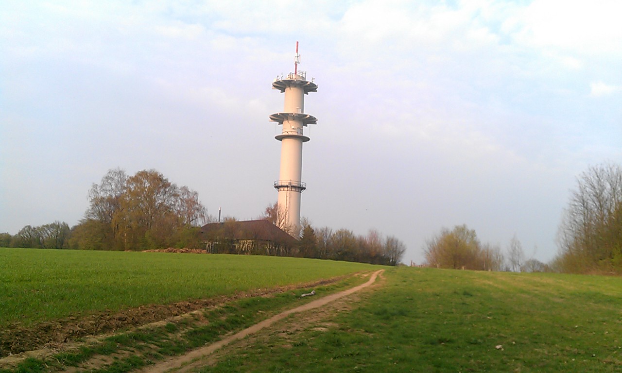 |
| The radio tower: remember this silhouette! |
The first part of the trail is totally unmarked. But don't worry, if you follow these directions, you should be fine. And if you get lost, what better spot to be running in circles than in this green paradise?
Just turn left and follow the edge of the field. At first, there is woods to your left, then another field opens up on the left side. Just follow the little unmarked path as it curves around to the right.
 |
| The unmarked path |
When you come to Dernbuschweg on the left, you come to your first farmhouse, the Trotzhof. There might be a few cars on the street here, but we'll soon get off this street.
 |
| Trotzhof farm: in 200 meters, turn right |
 |
| This is the way east to Schäperhof! |
 |
| The way downhill: watch those rocks! |
 |
| Keep going straight past the Schäperhof farmhouse. Note the trail markers |
 |
| I came across this shepherd and his goats near Schäperhof |
You will soon come to a series of ponds along the stream. At the last pond, the path sudden turns left to up over the next hill instead of following the water.
 |
| Along the ponds |
On the other side of the stream, at a farmhouse where the farmer has a love for old-timer cars and motorcycles, turn left and take the dirt road to the next farmhouse just a few hundred meters south.
Just before the fenced farmyard, turn left on the little path that heads along the fence, uphill towards the radio tower again. Another long climb!
 |
| Way back uphill to radio tower |
No comments:
Post a Comment