Showing posts with label Spain. Show all posts

Sunday, 8 March 2020

Aqua Liques Trail, Costa Calma, Fuerteventura Running Route

Click here for route map

Length 10.2 km (6.3 mi), terrain: fairly flat, gain 121 meters

NOTE: This is sandy, rocky desert country: make sure you bring water on hot days, avoid the afternoon heat, and watch your step!

When vacationing in the tourist hotel-town of Costa Calma, there are a few simple getaways waiting right at your doorstep. One of these is this 10K coast-to-coast run across the narrow El Jable sand desert that connects the southern Jandia peninsula to the rest of Fuerteventura.
The desert sands of El Jable
The island is only 5 kilometers wide at Costa Calma, with a whole different desert experience waiting for you just west of town. And on the other side waits the wild west coast, with its cliffs, peaks and booming surf.

NOTE: Other great Costa Calma runs include the two obvious beach runs: north of town along Playa Matas Blancas, or south of town along Playa de Sotavento.

In the park: nice jungle!
So if you're ready to try something different, and run across the desert, get yourself to the start of this route. Follow the long, jungly palm-park that lines Avenida Jahn Reisen through the whole town, and get to the El Palmeral Shopping Center. Now head behind the shopping center, northwest along Calle Playa de la Jaquerta, going through a local neighborhood towards the new bypass freeway.
El Palmeral Shopping Center: head out back to get onto the route!
At the end of the road, at the dusty lot next to the freeway, turn right to run along the dirt path. We need to head north for a block to find the tunnel that takes us under the freeway so we can get back to the same spot again on the other side.

The dirt trail takes you to the tunnel, where you run through it and then turn left to run the dusty road parallel to the freeway again until you are opposite Calle Playa de la Jaquerta, at almost the 2-kilometer mark. We're now across from where we were just a couple of minutes earlier.
The start of the cross-island trail
This is where the real trail across the desert begins. There's a big trail map on the wooden signboard for the Jandia nature preserve. You can take a look: basically, we just follow the jeep trail straight across the isthmus. We'll run parallel to that line of wind generators on the ridge to the left.

So now, just head northwest along the rocky, sandy trail. The beige, sandy soil is unique on Fuerteventura, joining the other dark-sand, volcanic areas to either side of El Jable.
Trail marker
Keep your eyes open for the light-blue-colored wooden posts marking the way. There will be occasional cross-trails, but we'll just ignore them until we reach the other coast.

If you look closely across the dune-like landscape, you might spy small herds of goats roaming the area. The desert vegetation is also worth taking a close look at: it's amazing how the plants have adapted to such a dry place. But don't forget: we're in a nature preserve, and we need to stay on the trails.
Goats roam the landscape
When we get to the highest spot, at about the 4-kilometer mark, we cross the island's north-south hiking trail, GR131, where there's a waymark. It's trail markers are painted red-white.
Crossing the north-south trail, GR 131
We keep running straight, there's just one more kilometer until we reach the west coast.

We'll soon come to a spot where several cross-trails split off, and the trail starts going downhill. We're almost there. Just keep running down the slope until the panorama of the ocean opens up and you find yourself standing above the cliffs of Aqua Liques, with amazing views in both directions. The powerful breakers stream-in from the northwest in a never-ending onslaught.
View north from Aqua Liques
You can go down to the water, but I'd stay out of it: there are a lot of rocks and riptides. In the week that I was there, two tourists drowned at this spot.  
And looking south
NOTE: If you want to extend the run, you could run north along the shoreline down on the ledge below the cliffs, near the water. It heads towards Los Boquetes. That's the next little promontory, which you can see, standing there at Aqua Liques.

So, once you've taken-in this impressive scene, it's time to turn around and follow the same trail back to town. Luckily, there are enough lounge-chairs and pool bars back in Costa Calma to quickly recover!
A little recovery time at the hotel!

Monday, 19 March 2018

El Teide National Park Running Route, Tenerifa

Click here for route map
Length 3.5 km (2.2 miles), terrain: rocky, one steep section, gain 211 meters

NOTE: If you like this short route, you might want to add-on one of the others that begin at the Parador.

The most spectacular place on the Canary island of Tenerifa is El Teide, the huge volcano dominating the island from every viewpoint. So you're almost sure to be drawn upwards to this fascinating stone wilderness, with other-worldly rock formations, lava flows, yellow sulphur vents and scrubby desert plants.
View over the caldera from the peak of El Teide
El Teide is enclosed within a national park. It's full of hiking trails and amazing vistas of the surrounding cliffs. If you're a runner who likes wide open spaces and amazing terrain -- and you don't mind the rough footing -- you'll find a few routes to your taste.

Our route in this post, the Roques de García, are a group of spectacular rocks down in the main caldera, or volcanic cone valley. The valley stretches out at the foot of the Teide peak, which is a much higher cone than the big one below it. The peak rises to over 3,700 meters, Spain's tallest mountain. The surrounding valley, with los Roques, is just over 2,000 meters high.
Some lava chimneys along the Los Roques trail
Los Roques provide a collection of amazing rock formations and volcanic chimneys, with a variety of local plants along the way. There is a lot of cactus and lots of white-flowered broom plants.

This trail circles los Roques, starting near the park lodge, the Parador. The lodge has parking, and -- even more important -- refreshments for later. The lodge is a meeting place for hikers and bicyclists from all over the island.
Looking back at the Parador and south rim from the trail
Quite a few hiking trails radiate out from the Parador, some heading along the southern crater wall, others heading northwards towards El Teide peak.

A paved foot-trail connects also the Parador to the nearby Roques de García trail, across the main park road. A parking area there means a lot of visitors stop at the base of Roques de García. But don't despair, after just a few minutes on the hiking trail itself, you'll hardly see anyone else.
Start of the trail at Los Roques
So, if you've gotten yourself up the seemingly endless serpentines on the road to El Teide, let's park near the Parador and wander over to Los Roques.

At the far end of the parking area, the rocks begin. There is a scenic lookout there, the Mirador de la Ruleta.
View towards El Teide from the trail
Look for the trail beginning to the right, Sendero 3, that heads north along the east side of the rock formations.

Now just head up the trail, with the rocks to your left side. The way is fairly flat here.
Formations along the trail
You'll go between volcanic chimneys, columns of magma which cooled before they reached the surface, and the surrounding rock weathered away.

Los Roques look like a steep, crumbling ridge, with rubble lying at the base of each rock. Between the stone towers, El Teide rises up along the northern horizon.

At about 700 yards, you'll pass a lava flow that came down the mountain from the north.

Past the first kilometer mark, another trail leads off upwards towards the second highest peak, the Pico Viejo.
Pico Viejo as seen from a high trail, with island of La Gomera in background
When you reach the 1.5-kilometer mark, the trail starts heading downhill into the valley called Llano de Ucanca, west of the rocks. You'll pass a lava flow called the La Cascada (The Waterfall), which looks like the flowing stone froze in mid-air.

The trail will continue downwards to the south, towards a solitary stone tower, called the Cathedral.
The Cathedral in shadows, on the right, as seen from higher rocks

You'll now pass right below the Cathedral, standing alone to the west of the others. At its base the trail now heads uphill fairly steeply, heading back to the Mirador de la Ruleta, passing the Cathedral

Way-markers at the base of the Cathedral. Keep left here, then uphill!

Once at the top, it's just a short walk back to the Parador to grab some pizza and a cold drink, and sit on their terrace for a view of this amazing national park!

Back at the Parador, with view of Los Roques and El Teide

Thursday, 30 November 2017

Tenerife, Playa de las Americas Running Route

Click here for route map
Length 14.2 km (8.8 miles) but you can shorten it by starting further north, terrain: a few small hills, gain 63m

NOTE: Do this route in the mornings when its cooler and the other tourists haven't started filling the promenade. Make sure you're back home by about 9:30 a.m.

Anyone staying in the tourist resorts of Tenerife's Playa de Las Américas area knows how busy and urban the whole place feels. So if you're looking to get away from the chaos to a bit more quiet and nature, just head north. The farther north you get, the more nature you'll find, and fewer people.

This route follows the beach promenade as far as it goes, 7 kilometers north to La Caleta from Los Cristianos. But you could begin wherever you are staying: Los Cristianos, Playa de Las Américas, San Eugenio, Torviscas or Costa Adeje.
Camisón in Los Cristianos
The official start of this route is at Playa del Camisón in Los Cristianos, at the La Palapa Beach Club. Los Cristianos has a double beach promenade: one close to the sand and another a bit further back, where most people walk. It's your choice.

So, just turn west, with the water to your left side, and keep on running until the sidewalk ends at La Caleta!

At first, you'll go by a surfing beach, El Cabezo Grande, before the trail heads northwards.
Surfers at a surf school at Playa de Las Américas
There are more surfing beaches at Playa de Las Américas, where the promenade, called Calle Francisco Fumero, is lined with cafés and shops.

For much of the run -- especially after Puerto Colon -- you'll have a choice of running along any of one-, two- or even three levels of promenades, or even head through the beach sand. It doesn't really matter which level you take, there are frequent steps to switch levels as you please.

After Playa de las Americas, Calle Francisco Rumero ends when it comes to a channelized, dry river, the Barranco del Rey. The promenade turns to the right to take you to Avenida Rafael Lluvina (unless you want to run straight onto the sand beach).
Typical promenade scene at Troya
Continue northwards past Playa de Troya along the wide sidewalk next to the avenue, past the notorious Monkey Beach Club, then follow the pedestrian promenade back down to the beach at Playa de Troya.

Now you're running past sand again, until Playa del Bobo ends, then comes a scenic stretch where the promenade rises up above some rocky cliffs with cool beach clubs built into the rocks.
Las Rocas Beach Club
The only dumb part of the run is coming up next: the two-block area around Puerto Colón, where you have to run next to a road and past a parking lot for the port. The promenade runs into Avenida de Colón, with a bit of harbor traffic, where you continue northwards.

When running along the avenue, you'll be up high, above the level of the port and beaches. When you cross over a street that rises up the hill below you, take the stairs down to the lower level at the sign  for "Centro Commercial Puerto Colón". This will take you down to the boat docks.
Approaching Puerto Colón: take those steps to the right!
You'll then run past the docks and come out to the red-paved promenade of Playa la Pinta.
At the harbor
You're now coming into Torviscas, where you'll have a choice of levels to run on, past Playa de Torviscas and Playa de Fañabé. The north end of Fañabé is where the beaches start getting nicer and more natural.
Fañabé and the rocks
The promenades join together to go up high over more cliffs.

NOTE: my favorite way to go in Fañabé is to run down to the sand and then continue over the rock ledges below Fañabé Beach Club. You'll have to slow down in a few dangerous spots, so watch out! And a few homeless people live under the rock ledges, so women might not want to run alone down there.

When you round the Fañabé Beach Club -- either above on the promenade or down on the rocks -- you'll have a great view of El Castillo del Duque, a stone mansion built out on top of the next rock outcropping. It's owned by local celebrities. 
Castillo del Duque as seen from Fañabé rocks
The whole area seems nicer, more upscale and exclusive from now on. No more English pubs and chips shops. There's a little mojito stand right there. It makes me wish I'd brought enough money for a cocktail!
Time for a mojito break, right?
Again, you can either follow the promenade past the mansion, or run on the rocks below it along the water at Las Toscas.

Either way, you'll now come to the area's best beach, Playa del Duque. It's lined with exclusive resorts and shops.
Playa del Duque
At the Riu Palace resort, they are constructing a new beach, which is interesting to watch.
Beach under construction
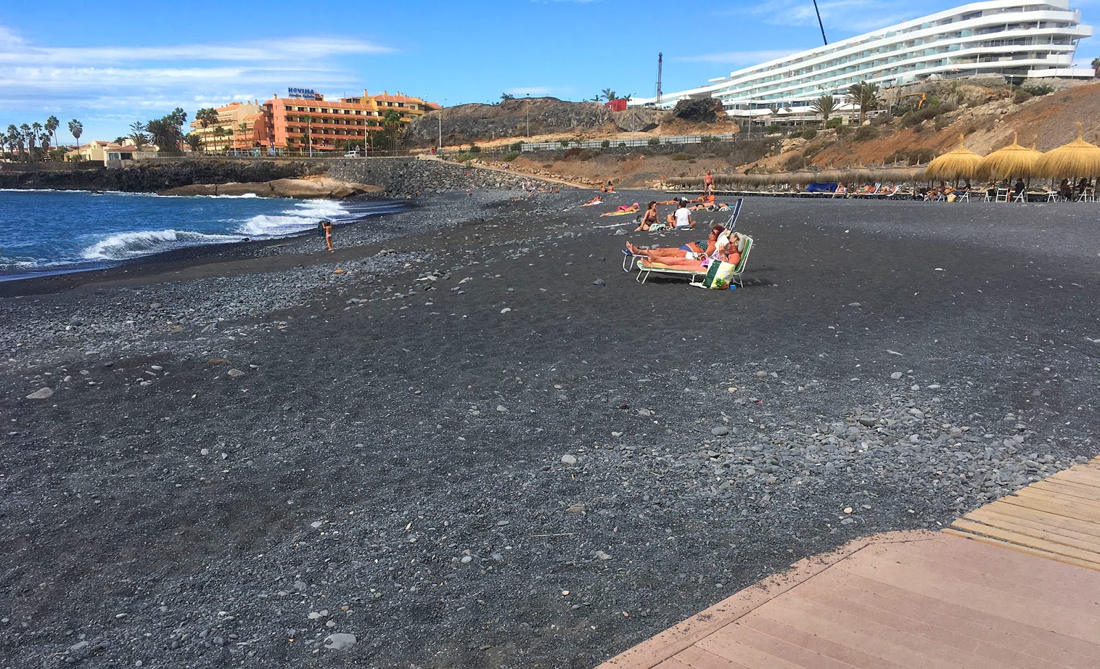
Then comes another dry river, the Barranco del Agua, at the Sheraton resort. This is lined by a somewhat weird sight: the pebble beach, where people have set up hundreds of little stone pyramids.
The pebble beach, with Las Palomas in the background
You now have to run around the back of another rock formation the circular Las Palomas (the pigeons).

There is just one more resort, the H10 Costa Adeje, then the promenade ends at Playa de La Enramada, just before La Caleta.
Enramada: end of the promenade
La Caleta is in the process of being extended way back into the hinterland, but it still has a bit of the feel of a little fishing village, with winding little lanes going down to waterfront houses built out onto the rocks. So you might want to continue and take a look, but there is no more pedestrian way to follow.

So that's it, time to turn around and head home. You get to enjoy it all from the other direction now. Enjoy!

Sunday, 8 October 2017

La Palma, Ruta de los Volcanes Trail Running Route

Click here for route map
Length 14.4 km (9 miles), terrain: very hilly, sometimes steep, gain 757 meters!

This is one amazing run. You'll transition from rain-forest shade forests to blasted, wide-open volcanic lava-flows. Sometimes you'll be in the clouds, sometimes you'll have views out over a carpet of clouds way below. You'll be stepping along the edge of craters, and viewing out across the Atlantic Ocean towards other islands. 
Trail view over the Atlantic towards Tenerifa
NOTE: This route is extremely rugged! It's steep, rocky, and you have to watch your step all the time. You might even prefer to hike it rather than to run it. But there are some hearty runners who traverse the rocky terrain like mountain goats. However you do it, make sure you bring a water bottle and a windbreaker! Walls of clouds can also suddenly move in, so watch their movement, and bring a good map and GPS. Plan it for a day when the ridge should be clear of clouds.

The Canary Islands isle of La Palma is the result of one huge volcano, then many smaller ones that followed through the millennia. No visit to the island is complete without a visit to the edges of the volcanic craters, some less than 50 years old.

This route follows the Ruta de los Volcanes (E7) hiking trail that winds along the peaks among a variety of volcanic cones and lava fields that popped up, one by one, forming the south end of the island. The route is normally well-marked, heading north-south almost the whole way.
El Pilar mist
We'll start it at one of my favorite spots on the island, El Pilar, a picnic park up in the clouds, and one of the most popular recreation areas for the islanders. Often, the clouds get stuck up here on the north/south ridge, and it looks like a rain-forest. Cloud-soaked Spanish moss drips from the trees, which disappear upwards into the swirling mist above.

The E7 hiking route begins a long ways north of here, circling the huge Caldera de Taburiente then heading southwards past all the main volcanic cones along the ridge of Cumbre Vieja, all the way to Fuencaliente, at the southern tip of the island. We'll just follow the middle section of the trail, Cumbre Vieja, where the biggest concentration of volcanoes and lava flows can be found.
Start of the run at El Pilar
El Pilar is off on a side-road from the main road between Santa Cruz and El Paso (watch for the signs to turn off), along the ridge that divides the eastern and western sides of the island. There is plenty of parking, so find a spot and put on your running gear!

Now walk to the area with the picnic shelters and playground swings on the south side of the road. If you walk past the playground to the far south end of the park, you'll see the waymarker signs for the hiking trail towards Fuencaliente, which begins going right up the hill. Did I mention that this is one difficult trail? Oops, well now is the time to tell you...
View northwards towards the Caldera de Taburiente
The trail heads uphill through pine woods towards the southwest, along the north flank of Pico Birigoyo, our first volcano. There are some nice views northwards towards the huge Caldera de Taburiente, La Palma's first volcano, the biggest volcanic crater in the world.

After a kilometer, the trees thin out and you have a wide view westwards, over the black lava fields of an eruption about 70 years ago.
View westwards over the clouds
After 2 kilometers, the trail heads down into a valley to join onto a jeep road, turning left, then heading uphill to the south. At different spots, you can see where recent fires have blackened the pine woods around you, but most of the trees survived.
Blackened pine tree along the way
After another half a kilometer, the trail leaves the jeep road and heads uphill southwards, passing a strange rock spiral that some people once laid out. The trail crosses a couple of wooden bridges and then takes you out over the ridge to the face the east side of the island.
Wooden bridge
At the 4.5-kilometer mark, you'll have a great view eastwards out over the ocean towards Tenerife. A few trails branch off here, heading downwards towards the east coast. But continue uphill, following the signs towards Fuencaliente.
Downhill runner at the trail branch-off
We are now in the high country, the trail will follow the Cumbre Vieja ridge for the rest of the way. This area is where the 1949 volcanic eruption happened, with lots of fairly fresh-looking lava flows.

Soon, at the 5-km mark, you'll come to the steep edge of a crater opening westwards, Volcán Hoyo Negro. The black and tan volcanic ash layers are strongly eroded into deep canyons. What a sight!
Volcán Hoyo Negro
Continuing southwards past some rocks with great views to more volcanoes. You'll face the blackend peak of Montaña de los Charcos across a lifeless, black valley of loose ash and rock.
Approaching Los Charcos
The trail takes you along its western side. The wind is wild up here at the peak, not a place to hang around!

Just south of los Charcos is a second cinder cone, Deseada, almost 2000 meters high. There are some cement markers along the trail here, with a couple of smaller trails heading off the the left (eastwards) that take you to the edge of Deseada and los Charcos.

Take one of those trails down to the crater edges and get a closer look at these other-worldly sights. You'll feel like you're on Mars.
Deseada and Los Charcos
But it's been 7 kilometers of hard trail climbing so far, so let's turn around and head back home now. There's still a long way to go to get back! And when you make it, kick off your shoes, shower off the sweat and grime, and it'll be time to tilt-back a well-earned glass of local La Palma wine!
Here's to one beautiful run!

Sunday, 23 July 2017

Madrid Cañada Trail Running Route

Click here for route map
Length 8 km (5 miles), terrain: hilly, gain 113 meters

Madrid running routes:
Madrid Old Town Sights route
Madrid Parque del Oeste route 
Madrid Parque del Retiro route

Madrid Casa de Campo trail run 
Madrid Rio Manzanares route
Madrid Cañadas trail run
For more running routes, see Route List.

NOTE: In the summer, Madrid is hot, normally around 35C degrees or even higher. Mornings are coolest and the best time to run, but even on hot evenings it can be doable, because often a strong breeze comes along in the evening, making things feel cooler.

The north side of Madrid is known for its modern suburbs and high-tech office parks. Lots of international companies have set up shop there, so you might end up hanging out there yourself.

But running past office buildings and malls might not be what you were hoping for in your time in Madrid. That's where this route comes in: exploring a section of Spanish countryside, with its rolling hills full of local plants and animals, grazing sheep, little farmsteads. A real trail run, and all that right on the edge of the suburbs.
Running group just leaving the cañadas
This route heads off from the new Montecarmelo neighborhood, with its own Metro stop (Line 10, "Montecarmelo"). So it's easy to get to.

The area is known for its little vineyards and orchards. Nowadays it is mainly used as meadows for sheep and horses, criss-crossed by dusty foot trails, the cañadas. This route follows those cañadas, historic cattle-drove roads through the hilly grasslands.

NOTE: The route is not well-marked. We'll follow the yellow arrows for the Camino de Madrid pilgrimage trail for the first few kilometers. But after that, there are no further waymarkers or road signs out along the cañadas. But if you watch the direction of the sun, and on the hill crests you look for the 2.5-km high peaks of the Sierra de Guadarrama mountains to the north and the skyscrapers around Chamartin train station to the south, you'll find good orientation points.
Head this way from the Metro station
Getting to the start: The neighborhood of Montecarmelo is a new, planned suburb served by Metro line 10 at the northern edge of Madrid. Get out of the Metro and, once outside, turn around to face the other direction, north.

Now, head north on the sidewalk through the narrow square from the Metro station until it ends a couple of blocks later at a wall, across Av. del Santuario de Valverde. There is a cemetery behind the wall. 
The cross along the Camino de la Cañada
Turn right and run the few meters to the next cross street and turn left to continue northwards along the east wall of the cemetery on the left, with basketball courts on the right. This dusty dirt trail is called Camino de la Cañada, and is used by lots of walkers, mountain bikers and runners.

Follow the trail as it heads downhill, past a cross marking the beginning of the Camino De Madrid pilgrimage trail towards Santiago de Compostela.

Mountains line the horizon to the north.

The trail seems to end at a popular red-painted asphalt track for bikers and pedestrians. But you need to continue straight down the steep embankment towards the railway and the M40 freeway ahead in the valley.
The tunnel under the freeway
The trail curves downwards to the left and then turns right to go under the tracks and freeway, at the 1-kilometer mark.

When you come out on the other side, you are suddenly in another world: little farmsteads and meadows along hillsides, with rutted, dusty trails winding between them. Follow the yellow arrows for the Camino De Madrid trail.

After 100 meters, at a fenced field, take the right-hand trail as it splits, which is still called Camino de la Cañada. There is a yellow arrow pointing the way. We'll later return from the left-hand trail.
Waymarker for the Camino de Madrid
Now just follow this trail for two kilometers. Go under the power transmission lines, heading straight north.

Head gradually uphill towards the rolling hilltop meadows, amid grazing sheep. A couple of other trails will merge from the right side.

Enjoy the beautiful stretches of Spanish plant- and animal-life. The fields are full of pale thistles that look like miniature Atomiums, broom bushes, grasses, thorn trees. I saw a harmless snake, rabbits, hawks, doves. Listen to the locusts chirping. I saw a shepherd with his border collie watching over a big herd of grazing sheep.
Rabbit holes in the arroyo
There are also a couple of horse ranches in the area, so you might encounter some riders. But mainly, it's mountain bikers and runners out here.

At the 3-kilometer mark, you'll see a valley beginning to your left side, stretching to the southwest. That is the Arroyo de Valdecervero. Turn left onto the trail that heads down into the valley. At first, there is no real stream-bed in the valley, but as you continue, you can see it form. Follow it as the gulch gradually gets deeper, full of raspberries and rabbit holes.
Along the arroyo
There are trails along each side of the gulch. Take your pick. You'll see the transmission lines again as we run towards them in the distance.

Just before the 5-kilometer mark, at the first major crossroads with another wide trail, look for a little fenced farmstead off to the left, up the hill to the south. Turn left there.

NOTE: Don't worry, you can take any turnoff to the left to get back, actually.
Turn and follow this trail up past the fenced-in farm
Head up and over the hill, passing the party pavilion of the farm and then more fenced-off areas. At the top of the hill, when you come to the power transmission lines, take the trail to the left. You'll be able to see Montecarmelo across the valley, past the freeway.

You'll then pass a fenced-in orchard on your right side, as well as some old cement gateposts on the left. Just continue downhill as you pass the 6-km mark.
The gateposts and orchard: keep going straight!
You'll see Montecarmelo ahead, past the motorway. There is a long, white building with two black glass stripes of windows to the left of the way we came.

You'll also see a line of trees down in the valley: another arroyo, the Arroyo del Monte, but this one is lusher, supporting a thick growth of trees and other plants.

Turn left at the arroyo and follow the path eastwards. You can clearly hear the nearby freeway to the right. The path will wind along the arroyo for a while.
Along the Arroyo del Monte
When you come to a ruined farmstead, you'll see a fenced-off field. This the first fenced-off field that we saw right after we entered the area. At the end of the fence, turn right and follow the same trail that we came in on, going under the freeway at the 7-km mark, and then to the left up the hill, all the way back to the Metro station.