Length 7.7 km (4.8 miles) or a shorter 4.2 km version, terrain: flat
Manchester running routes:
City center route
Salford Quays route
Rochdale Canal route
Worsley route
For more running routes, see Route List.
Manchester, like nearby Birmingham, lacks large parks or green areas in the town center where you can go for a quiet run. The few tiny parks are called "gardens" and are hardly big enough to let you run more than 15 seconds in any direction. But -- and here's another similarity to Birmingham -- there are some really nice canalside and riverside trails to run along, keeping you away from loud traffic and providing a lot of great scenery.
 |
| Narrow-boats maneuver into a lock along Canal Street |
The canal goes through a variety of neighborhoods, and is full of ancient boat locks, heading by old factories, offices, ship basins, parks: enough to keep anyone entertained.
So if you're ready, let's head to Manchester's main train station, Piccadilly, in the southeast corner of downtown. This is an easy spot to get to, as about all the tram- and bus lines head there.
Standing at the front entrance, outside the station, you'll see a modern, white footbridge leading over Piccadilly Street to the west. Run across the bridge and down past the Doubletree Hotel and then continue into the intersection ahead, the one with the tram tracks. Keep running west past the red-brick building (the Manchester Crown Court!) with the Rochdale Canal right in front of it.
 |
| Along Canal Street |
Canal Street is one of the nicest streets downtown, with the water and shade-trees and a couple of boat-locks, and you might well see some narrow-boats moving from lock to lock. Canal Street also forms the heart of the Gay Village, lined with clubs and bars for its short 3-block existence. In the evenings, it's full of people, in the daytime it's totally tranquil.
At the west end of Canal Street, you have to cross the canal again and then take the steps down to the towpath along its southern bank. This is where you really get down close to the canal. Now continue running westwards, directly along the water's edge.
 |
| The canal disappears under this building ahead |
After you go under Albion Street, you'll come to the next area for clubs, Deansgate Locks, with a group of bars with terraces up above the canal, with little footbridges overhead.
 |
| At Deansgate Locks |
NOTE: At this spot, this run overlaps the Manchester City Centre running route.
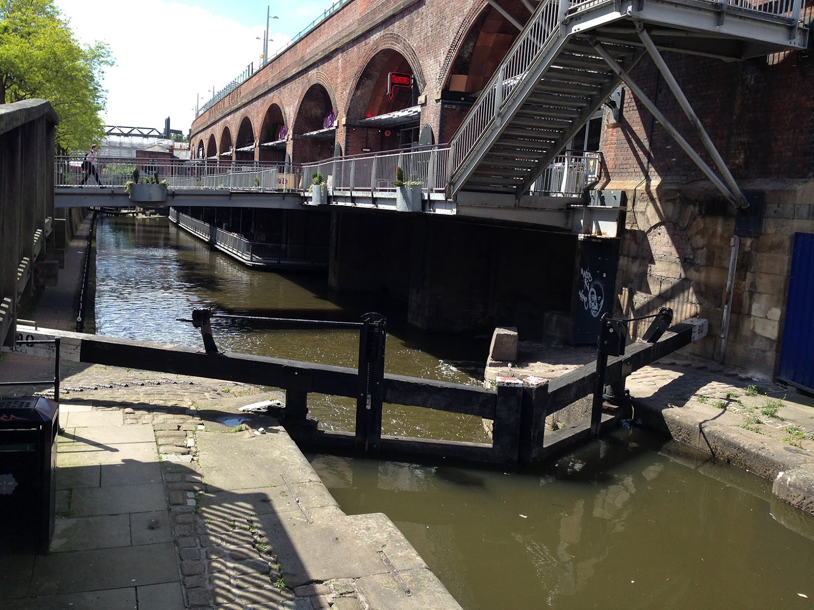
 |
| Lock at the end of the towpath |
 |
| Castlefield basin |
 |
| Narrow-boat skipper and crew in Castlefield |
Now turn right and run eastwards along Liverpool Street to the next street corner, to the sign for the Museum of Science and Industry, which houses all kinds of things produced in Manchester, from steam engines to jet engines (there's free entrance!).
 |
| MOSI: turn left here |
 |
| Airplanes in MOSI |
 |
| Roman gate-tower |
 |
| St. Johns Gardens |
In a couple of blocks you'll run past the Manchester CCC (ex central train station, now a convention center).
Now cross Lower Mosley Street, heading downhill on Bishopsgate, past the Premier Lodge Hotel and then some old row-houses.
At the next street, Cheapstow, turn left and run the next three blocks to Princess Street. Turn right here and run southwards, back to the west end of Canal Street at the New Union pub.
Now turn left and follow Canal Street the three blocks back to the Crown Court building where we first came to the canal. You could turn right here at the tram tracks and footbridge and head back to Piccadilly Station, for a 4.2-km run. Or you add the following extension by following the Rochdale Canal eastwards for a bit to add another three kilometers to the total. Here's how:
Keep running northeastwards along the canal for a block until you come to Piccadilly Street, which you cross. You are now on Ducie Street. Follow that for about two blocks until you see a parking lot open up on the left side.
Turn left into the parking lot and cross it to the canal. You'll see a couple of places where steps go down to the canal towpath.
Now turn right and follow the towpath northeastwards for about 200 meters until it goes under a big street, Great Ancoats.
Now the towpath ends, at least for now. The land ahead has been cleared for redevelopment, and I expect the towpath will be reopened in the next few years. For now, you'll have to go up to Great Ancoats Street, cross the bridge to the other side of the canal and now continue northeastwards along Redhill Street.
 |
| Heading up Redhill Street |
You could now run eastwards for miles, but this route will stop at Victoria Mill Park, at the little Navigation Inn pub. Now just return to Piccadilly, where you turn left to run the one block back to the station.
Hi, thanks for the route. Great run. Cobblestone a little hard work on the ankles, but it is only a short distance. Still a little bit of construction on the towpath as of Aug 2015, but can easily get around it.
ReplyDeleteCheers!
Glad you enjoyed it, Scott!
ReplyDelete